State University of Surabaya, Surabaya
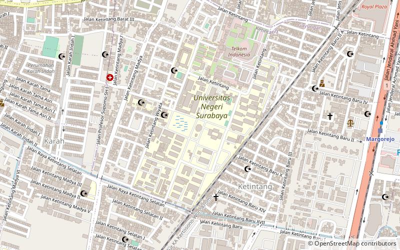
Map
Facts and practical information
The State University of Surabaya or Surabaya State University is a public university in Indonesia. It is one of the top universities in Indonesia. It is ranked 19 in University Rankings 2020 by the Minister of Education and Culture, which indicates the State University of Surabaya or Surabaya State University as the top 3 public universities in Surabaya, East Java along with Airlangga University and Sepuluh Nopember Institute of Technology. ()
Address
Surabaya
ContactAdd
Social media
Add
Getting there by public transportation
Public transportation stops near this location
- Bus
- Train
 Bus
Bus
- Calculate routeMargorejo 14 min walk
- Calculate routeJemursari 28 min walk
- Calculate routeStasiun Wonokromo 31 min walk
- Calculate routeWonokromo 31 min walk
- Calculate routeStasiun Wonokromo 31 min walk
- Calculate routeTerminal Intermoda Joyoboyo 32 min walk
Day trips


Frequently Asked Questions (FAQ)
How to get to State University of Surabaya by public transport?
The nearest stations to State University of Surabaya:
Train
Bus
Train
- Margorejo (14 min walk)
- Jemursari (28 min walk)
Bus
- Stasiun Wonokromo (31 min walk)
- Terminal Intermoda Joyoboyo (32 min walk)