Trek Zone

Kenmare Stone Circle, Kenmare

#4 among attractions in Kenmare

Sightseeing
Kenmare Stone Circle

Facts and practical information

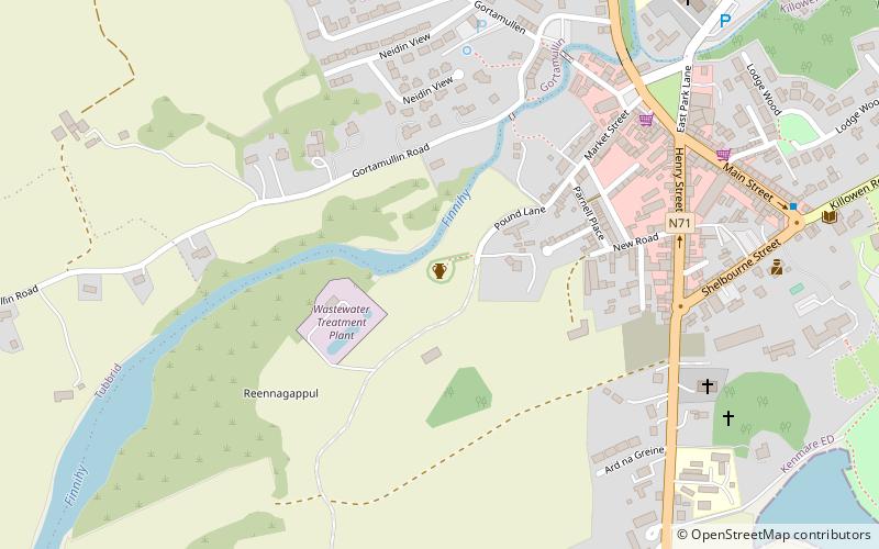
Kenmare Stone Circle (address: POUND LANE) is a place located in Kenmare (Kerry county) and belongs to the category of sightseeing.

It is situated at an altitude of 23 feet, and its geographical coordinates are 51°52'42"N latitude and 9°35'18"W longitude.

Among other places and attractions worth visiting in the area are: Skyline Gallery (shopping, 5 min walk), Kenmare Library and Carnegie Arts Centre (library, 9 min walk), Dunkerron Castle (forts and castles, 36 min walk).

Coordinates: 51°52'42"N, 9°35'18"W
Address

POUND LANEKenmare Ireland

ContactAdd
Social media
Add

Kenmare plan & book

Unleash the traveler in you — discover the cheapest flight deals, find the perfect hotel or hostel nearby, and search for the best car rental prices. Travel at your own pace to discover new places and enjoy your journey.

Day trips

Kenmare Stone Circle – popular in the area (distance from the attraction)

Nearby attractions include: Uragh Stone Circle, Moll's Gap, Uragh Wood, Skyline Gallery.

  • uragh stone circle cloonee and inchiquin loughs6.5 miSW
  • molls gap killarney5.1 miNW
  • uragh wood cloonee and inchiquin loughs6.8 miSW
  • skyline gallery kenmare~1030 ftE
  • dromore castle location map
    5.7 miW
  • the black valley5.5 miNW
  • kenmare library and carnegie arts centre~1720 ftE
  • dunkerron castle1.4 miW

Frequently Asked Questions (FAQ)

Which popular attractions are close to Kenmare Stone Circle?

Nearby attractions include Skyline Gallery, Kenmare (5 min walk), Kenmare Library and Carnegie Arts Centre, Kenmare (9 min walk).

Where to next? Visit kerry Kerry region page or discover the top tourist attractions in Ireland.

IrelandCarlowCavanClareCorkDonegalDublinGalwayKerryKildareKilkennyLaoighisLeitrimLimerickLongfordLouthMayoMeathMonaghanOffalyRoscommonSligoTipperaryWaterfordWestmeathWexfordWicklow