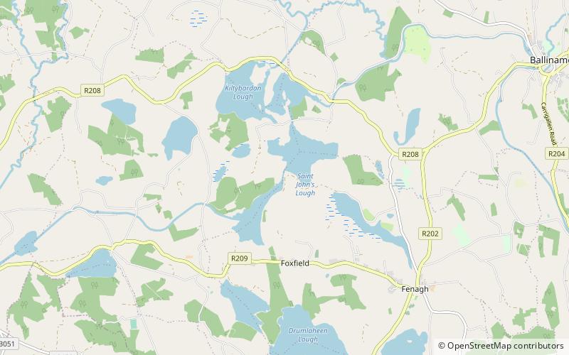
St. John's Lough
Map
Facts and practical information
St. John's Lough, also known as St. John's Lake, is an irregularly shaped freshwater lake located in south County Leitrim, in northwest of Ireland. The lake forms part of the wider Shannon–Erne Waterway tourist attraction. The ecology of John's Lough, and the Shannon-system, is threatened by pollution and invasive species such as curly waterweed, zebra mussel, and freshwater clam. ()
Length: 9843 ftMaximum depth: 16 ftElevation: 203 ft a.s.l.Coordinates: 54°2'10"N, 7°51'57"W
Location
Leitrim
ContactAdd
Social media
Add
Day trips