Swiss Forest, Tiberias
Facts and practical information
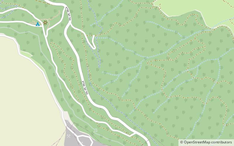
Nestled in the northern reaches of Israel, the Swiss Forest in Tiberias is a serene escape that stands as a testament to the collaboration between nations and the love for nature. This verdant oasis, planted by the Jewish National Fund with the support of donors from Switzerland, offers a tranquil retreat from the bustling city life and a chance to reconnect with the great outdoors.
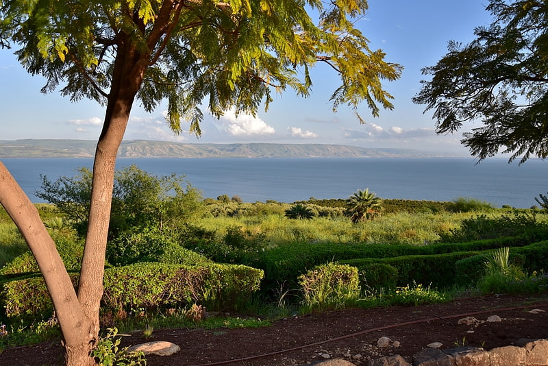
The forest is strategically situated to provide breathtaking views of the Sea of Galilee and the Golan Heights, making it a popular destination for both tourists and locals seeking a peaceful haven. Its lush landscape is dotted with a variety of trees, including oak, carob, and pine, which contribute to the forest's vibrant ecosystem and provide shade for visitors during the warm Mediterranean summers.
Visitors to the Swiss Forest can indulge in a range of activities. Well-marked hiking trails invite nature enthusiasts to explore the area's natural beauty, while designated picnic areas offer the perfect setting for a family outing or a romantic getaway. For those looking to delve into the historical aspect of the region, the forest is also home to several ancient ruins and sites of archaeological interest.
The forest's maintenance and preservation efforts ensure that it remains a green lung for the city of Tiberias, contributing to the region's environmental sustainability and providing a habitat for local wildlife. The Swiss Forest is not only a place of recreation but also serves as an educational resource, highlighting the importance of conservation and the impact of international cooperation in environmental projects.
Tiberias
- Bus
 Bus
Bus
- Calculate routeTiberias central bus station 30 min walk


Frequently Asked Questions (FAQ)
How to get to Swiss Forest by public transport?
Bus
- Tiberias central bus station (30 min walk)