Horns of Hattin, Mount Arbel
#2 among attractions in Mount Arbel

Facts and practical information
The Horns of Hattin is an extinct volcano with twin peaks overlooking the plains of Hattin in the Lower Galilee, Israel. ()
Mount Arbel plan & book
Unleash the traveler in you — discover the cheapest flight deals, find the perfect hotel or hostel nearby, and search for the best car rental prices. Travel at your own pace to discover new places and enjoy your journey.
Horns of Hattin – popular in the area (distance from the attraction)
Nearby attractions include: Sea of Galilee, Church of the Primacy of Saint Peter, Nabi Shu'ayb, St. Peter's Church.
 Lake popular with Christian pilgrims
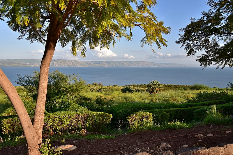
Sea of Galilee, Tiberias
119 min walk • Nestled in the northern region of Israel, the Sea of Galilee, also known as Lake Kinneret, is a serene freshwater lake that holds profound historical and religious significance. This tranquil body of water, situated near the city of Tiberias, is the lowest freshwater...
 Church connected with a miracle of Jesus
Church of the Primacy of Saint Peter, Tabgha
187 min walk • The Church of the Primacy of Saint Peter is a Franciscan church located in Tabgha, Israel, on the northwest shore of the Sea of Galilee. It commemorates, and allegedly marks the spot, of Jesus' reinstatement of Peter as chief among the Apostles.
 Tomb
TombNabi Shu'ayb
19 min walk • Nabi Shuʿayb is an Islamic and Druze religious prophet, traditionally identified with the biblical Jethro, whose possible shrine/tomb is believed to be located near Kfar Zeitim, not far from Tiberias, Israel. The identification of Shuʿayb with Jethro, however, is a Druze tradition rather than historical fact.
 Church
St. Peter's Church, Tiberias
125 min walk • Nestled in the ancient city of Tiberias, Israel, St. Peter's Church stands as a serene testament to faith and history on the western shores of the Sea of Galilee. This modest yet significant church is a beacon of the Christian presence in the region, attracting...
 Nature, Natural attraction, Mountain
Mount Nitai, Mount Arbel
63 min walk • Mount Nitai, sometimes spelled Nitay, is a mountain in Israel; it is situated west of the Sea of Galilee and north of the city of Tiberias and is due west of Mount Arbel. Har Nitai is named after Nittai of Arbela.
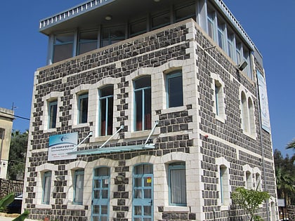 Museum
Maimonides Heritage Center, Tiberias
117 min walk • Nestled in the historic city of Tiberias, Israel, the Maimonides Heritage Center stands as a testament to the life and teachings of one of Judaism's most revered figures, Rabbi Moses ben Maimon, also known as Maimonides or Rambam.
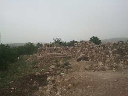
 Archaeological site
Hurvat Amudim
79 min walk • Hurvat Amudim or Sde Amudim was an ancient village, now an archaeological site, in Israel, located south-east of the Beit Netofa Valley, on the eastern side of Highway 65 between Golani Interchange and Kadarim Junction.
 City, Archaeological site
Magdala
102 min walk • Magdala was an ancient Jewish city on the shore of the Sea of Galilee, 3 miles north of Tiberias. In the Babylonian Talmud it is known as Magdala Nunayya, and which some historical geographers think may refer to Tarichaea, literally the place of processing fish.
 Museum, Archaeological museum
Hammat Tiberias
142 min walk • Hammath Tiberias or Hammat Tiberias is an ancient archaeological site and an Israeli national park known as Hamat Tverya National Park, which is located on the adjacent to Tiberias on the road to Zemach that runs along the shore of the Sea of Galilee.
 Prehistoric site
Mugharet el-Zuttiyeh
143 min walk • Mugharet el-Zuttiyeh is a prehistoric archaeological site in Upper Galilee, Israel. It is situated 800 m from the Nahal Amud outlet, approximately 30 m above the wadi bed.
 Caravanserai
Khan al-Tujjar
153 min walk • al-Tujjar Caravansarai are the ruins of a caravanserai in the Lower Galilee, Israel, opposite the entrance to Beit Keshet.