Chyulu Hills

Facts and practical information
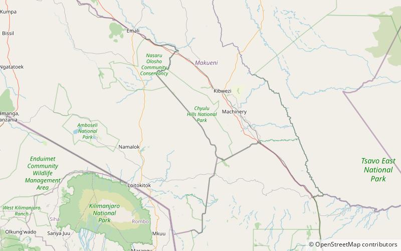
The Chyulu Hills is a mountain range in Makueni County, South Eastern Kenya. It forms a 100 kilometre long volcanic field in elongated NW-SE direction. Its highest peak is 2188 metres high. ()
Best Ways to Experience the Park
Wildlife
AnimalsSee what popular animal species you can meet in this location.
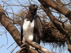
Martial eagle
The martial eagle, a majestic and formidable bird of prey, inhabits sub-Saharan Africa. It is the sole member of its genus, Polemaetus, and belongs to the booted eagle subfamily, distinguished by feathers that extend down their legs.
Birds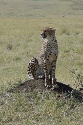
East African cheetah
The East African cheetah roams the grasslands and savannas of East Africa, inhabiting countries such as Tanzania, Kenya, Uganda, and Somalia. They are particularly prevalent within the Serengeti ecosystem and Maasai Mara.
Mammals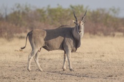
Common eland
The common eland, also known as the southern eland or eland antelope, is a majestic animal that roams the savannahs and plains of East and Southern Africa. Belonging to the Bovidae family and the genus Taurotragus, these antelopes are among the largest in the world.
Mammals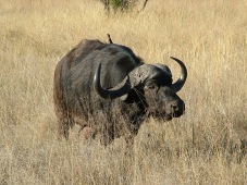
Cape (African) Buffalo, Bushcow
The African buffalo, also known as the Cape buffalo, is a formidable bovine species native to sub-Saharan Africa. Comprising several subspecies, the Cape buffalo is the largest and most prevalent in Southern and Eastern Africa.
Mammals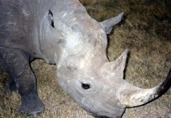
Eastern black rhinoceros
The eastern black rhinoceros, also known as the East African black rhinoceros or eastern hook-lipped rhinoceros, is a critically endangered subspecies of the black rhinoceros. Due to extensive poaching for their horns, their population has decreased by 90% over the...
Mammals