Lallange, Esch-sur-Alzette
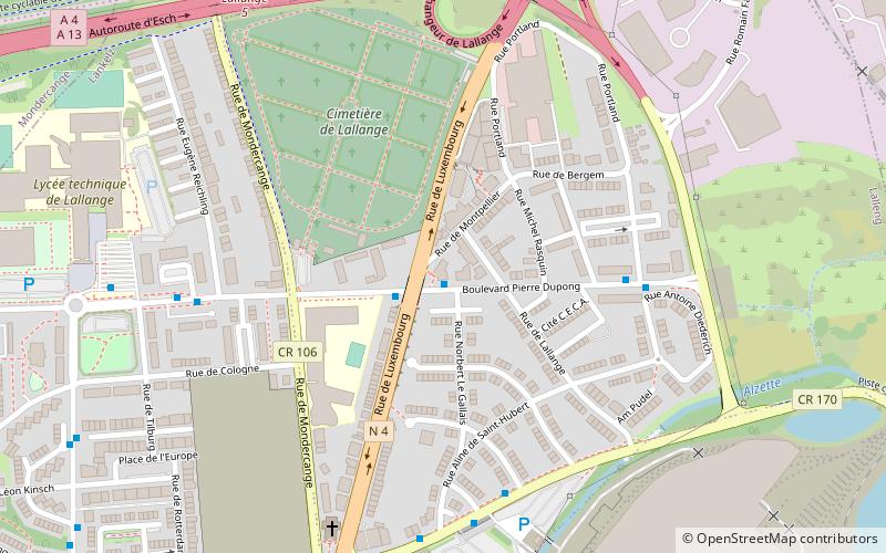
Map
Facts and practical information
Lallange is a quarter in northern Esch-sur-Alzette, in south-western Luxembourg, Europe. ()
Address
Esch-sur-Alzette
ContactAdd
Social media
Add
Getting there by public transportation
Public transportation stops near this location
- Bus
- Train
 Bus
Bus
- Calculate routeEsch, Lallenger Schoul 1 min walk
- Calculate routeEsch, Bd Hubert Clement 6 min walk
- Calculate routeSchifflange 23 min walk
- Calculate routeEsch-sur-Alzettte 31 min walk
Day trips


Frequently Asked Questions (FAQ)
How to get to Lallange by public transport?
The nearest stations to Lallange:
Bus
Train
Bus
- Esch, Lallenger Schoul • Lines: 7 (1 min walk)
- Esch, Bd Hubert Clement • Lines: 307, 7 (6 min walk)
Train
- Schifflange (23 min walk)
- Esch-sur-Alzettte (31 min walk)