KNRM Hoek van Holland, Hook of Holland

Gallery (1)
Map
Map
Facts and practical information
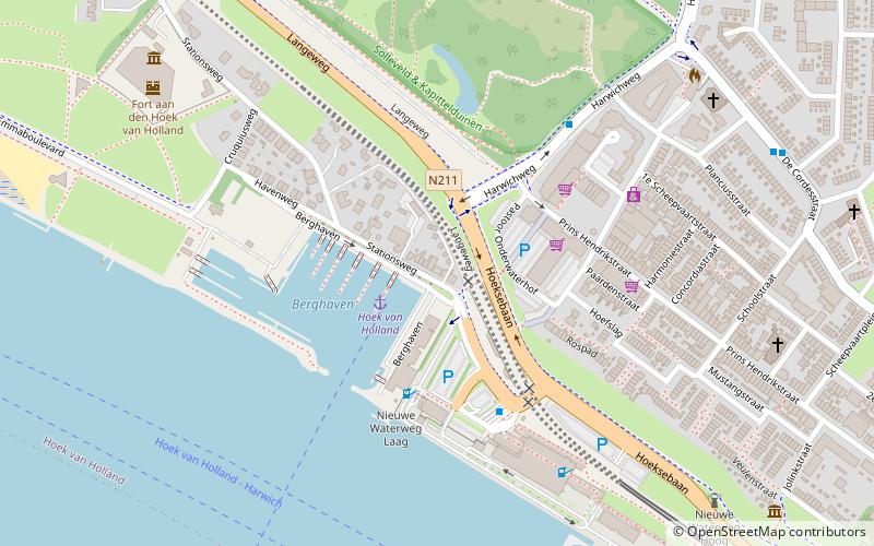
KNRM Hoek van Holland (address: Stationsweg 25) is a place located in Hook of Holland (Zuid-Holland province) and belongs to the category of sightseeing.
It is situated at an altitude of 13 feet, and its geographical coordinates are 51°58'39"N latitude and 4°7'35"E longitude.
Among other places and attractions worth visiting in the area are: Fort aan den Hoek van Holland (museum, 8 min walk), Nieuwe Waterweg Hoog (lighthouse, 8 min walk), Atlantikwall Museum (museum, 20 min walk).
Coordinates: 51°58'39"N, 4°7'35"E
Address
Stationsweg 25Hoek van Holland (Strand en Duin)Hook of Holland
Contact
Social media
Add
Day trips


Frequently Asked Questions (FAQ)
Which popular attractions are close to KNRM Hoek van Holland?
Nearby attractions include Fort aan den Hoek van Holland, Hook of Holland (8 min walk), Nieuwe Waterweg Hoog, Hook of Holland (8 min walk), Atlantikwall Museum, Hook of Holland (20 min walk).