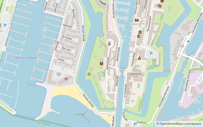
Fort Haerlem, Hellevoetsluis

Facts and practical information
Fort Haerlem is a place located in Hellevoetsluis (Zuid-Holland province) and belongs to the category of sightseeing.
It is situated at an altitude of 16 feet, and its geographical coordinates are 51°49'24"N latitude and 4°7'37"E longitude.
Planning a visit to this place, one can easily and conveniently get there by public transportation. Fort Haerlem is a short distance from the following public transport stations: Vesting (bus, 9 min walk).
Among other places and attractions worth visiting in the area are: De Hoop (monuments and statues, 3 min walk), Nederlands Hervormde Kerk (church, 4 min walk), Nationaal Brandweer Museum (history museum, 5 min walk).
Hellevoetsluis
- Bus
 Bus
Bus
- Calculate routeVesting 9 min walk
- Calculate routeVlasakkerlaan 14 min walk
- Calculate routeJan Blankenstraat 18 min walk
- Calculate routeProv.weg/Smitsweg 19 min walk
Fort Haerlem – popular in the area (distance from the attraction)
Nearby attractions include: Droogdok Jan Blanken, De Hoop, Museumschip "Buffel", Noord-Hinder.


Frequently Asked Questions (FAQ)
Which popular attractions are close to Fort Haerlem?
How to get to Fort Haerlem by public transport?
Bus
- Vesting • Lines: 105, 91 (9 min walk)
- Vlasakkerlaan • Lines: 105, 91 (14 min walk)