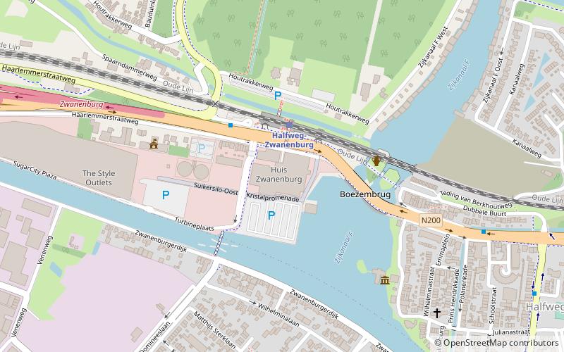
Gemeenlandshuis Zwanenburg, Amsterdam
Map
Facts and practical information
The Gemeenlandshuis Zwanenburg on the Haarlemmerstraatweg in Halfweg is a former Gemeenlandshuis of the Hoogheemraadschap van Rijnland designed by Pieter Post and built 1645-1648. Today it is part of Sugar City. ()
Address
Amsterdam
ContactAdd
Social media
Add
Getting there by public transportation
Public transportation stops near this location
- Bus
- Train
 Bus
Bus
- Calculate routeStation Halfweg-Zwanenburg 2 min walk
- Calculate routeOranje Nassaustraat 9 min walk
- Calculate routeWilgenlaan 11 min walk
- Calculate routeHalfweg-Zwanenburg 2 min walk
Maps Metro / Trams
Metro / TramsDay trips


Frequently Asked Questions (FAQ)
How to get to Gemeenlandshuis Zwanenburg by public transport?
The nearest stations to Gemeenlandshuis Zwanenburg:
Bus
Train
Bus
- Station Halfweg-Zwanenburg • Lines: 161, 680, 80, MeerOVBus (2 min walk)
- Oranje Nassaustraat • Lines: 161, 680, 80 (9 min walk)
Train
- Halfweg-Zwanenburg (2 min walk)