Snoekjesgracht, Amsterdam
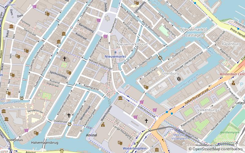
Map
Facts and practical information
Address
Stadsdeel Centrum (Nieuwmarkt en Lastage)Amsterdam
ContactAdd
Social media
Add
Getting there by public transportation
Public transportation stops near this location
- Metro
- Bus
- Tram
- Train
- Ferry
 Metro
Metro
- Calculate routeNieuwmarkt 2 min walk
- Calculate routeWaterlooplein 7 min walk
- Calculate routeRokin 10 min walk
- Calculate routeWaterlooplein 6 min walk
- Calculate routePrins Hendrikkade 9 min walk
- Calculate routeWaterlooplein 6 min walk
- Calculate routeMeester Visserplein 7 min walk
- Calculate routeRembrandtplein 9 min walk
- Calculate routeRokin 10 min walk
- Calculate routeAmsterdam Central Station 16 min walk
- Calculate routeCentraal Station 16 min walk
- Calculate routeIJplein 22 min walk
Maps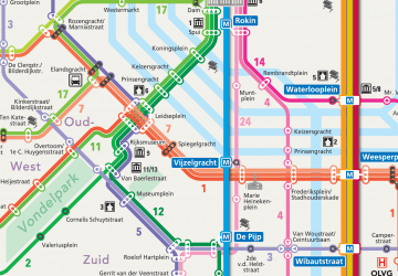 Metro / Trams
Metro / TramsDay trips


Frequently Asked Questions (FAQ)
Which popular attractions are close to Snoekjesgracht?
Nearby attractions include Huis De Pinto, Amsterdam (1 min walk), Sint Antoniesbreestraat, Amsterdam (2 min walk), Kromboomssloot, Amsterdam (2 min walk), Houtkopersburgwal, Amsterdam (2 min walk).
How to get to Snoekjesgracht by public transport?
The nearest stations to Snoekjesgracht:
Metro
Bus
Tram
Train
Ferry
Metro
- Nieuwmarkt • Lines: 51, 53, 54 (2 min walk)
- Waterlooplein • Lines: 51, 53, 54 (7 min walk)
Bus
- Waterlooplein • Lines: 246, N86, N87, N89, N91, N93 (6 min walk)
- Prins Hendrikkade • Lines: 22, 305, 306, 314, 316, 391, 394, 43, N01, N04, N14, N92, N94 (9 min walk)
Tram
- Waterlooplein • Lines: 14 (6 min walk)
- Meester Visserplein • Lines: 14 (7 min walk)
Train
- Amsterdam Central Station (16 min walk)
Ferry
- Centraal Station • Lines: F2 (16 min walk)
- IJplein • Lines: F2 (22 min walk)