Stad Doetinchem, Doetinchem
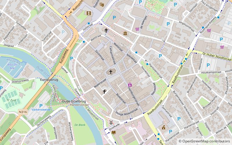
Map
Facts and practical information
Stad Doetinchem is a former municipality in the Dutch province of Gelderland. It consisted of the city of Doetinchem and its immediate surroundings. The larger surrounding countryside was a separate municipality, called Ambt Doetinchem. ()
Coordinates: 51°57'56"N, 6°17'20"E
Address
Doetinchem
ContactAdd
Social media
Add
Getting there by public transportation
Public transportation stops near this location
- Bus
- Train
 Bus
Bus
- Calculate routeCentrum 3 min walk
- Calculate routeGruitpoort 4 min walk
- Calculate routeRaadhuisstraat 6 min walk
- Calculate routeDoetinchem 15 min walk
Day trips


Frequently Asked Questions (FAQ)
Which popular attractions are close to Stad Doetinchem?
Nearby attractions include Simonsplein, Doetinchem (1 min walk), Stadsmuseum, Doetinchem (4 min walk), D-Toren, Doetinchem (4 min walk), Vrijheidsmonument Doetinchem, Doetinchem (4 min walk).
How to get to Stad Doetinchem by public transport?
The nearest stations to Stad Doetinchem:
Bus
Train
Bus
- Centrum • Lines: 1, 27, 29, 612, 627, 628, 682, 82 (3 min walk)
- Gruitpoort • Lines: 1 (4 min walk)
Train
- Doetinchem (15 min walk)