Wilmot Pass, Fiordland
Map

Map

Facts and practical information
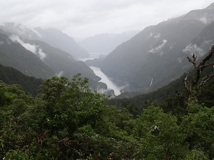
The Wilmot Pass is a 671 m high pass on the main divide of New Zealand's South Island. It connects Doubtful Sound, a deep indentation in the coast of Fiordland, to the valley of the West Arm of Lake Manapouri. The pass is named after E. H. Wilmot, a former surveyor-general of New Zealand, who had noted it while surveying the area in 1897. It lies between Mount Wilmot and Mount Mainwaring. On the east side the Spey River drains to Lake Manapouri and on the west side the Lyvia River drains to Deep Cove. ()
Coordinates: 45°30'0"S, 167°10'59"E
Address
Fiordland
ContactAdd
Social media
Add
Day trips
Wilmot Pass – popular in the area (distance from the attraction)
Nearby attractions include: Lady Alice Falls, Helena Falls.


