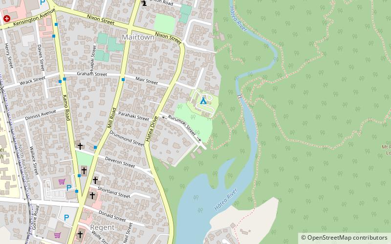
Mair Park, Whangārei
Facts and practical information
Nestled in the heart of Whangārei, New Zealand, Mair Park is a verdant oasis that offers locals and visitors alike a peaceful escape from the hustle and bustle of city life. This serene park, known for its lush landscapes and tranquil atmosphere, serves as a green lung for the city, providing a space for relaxation, recreation, and reflection.
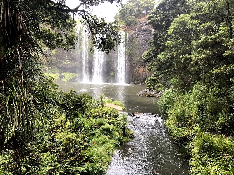
Mair Park is characterized by its well-maintained pathways that meander through native bushland, leading to the picturesque banks of the Hatea River. The park's diverse flora includes a remarkable collection of native trees, ferns, and flowering plants, creating a habitat that supports a variety of birdlife. Nature enthusiasts will appreciate the park's dedication to conservation and the opportunity to observe New Zealand's unique wildlife in its natural environment.
The park's layout is thoughtfully designed to accommodate a range of activities. Open grassy areas are perfect for picnics, family gatherings, or simply lounging under the shade of a towering tree. For the more active, Mair Park has several walking tracks that vary in difficulty, including the popular Parihaka walk, which leads to the summit of the iconic Parihaka Mountain. From here, adventurers are rewarded with panoramic views of Whangārei and its surrounding landscapes.
Mair Park is not only a haven for nature lovers but also a site of cultural significance. The park is named after the Mair family, who were prominent figures in the early history of Whangārei. Their legacy is commemorated within the park, highlighting the area's rich heritage and the important role it has played in the community's development.
Whangārei
- Bus
 Bus
Bus
- Calculate routeDent Street Bus Station 23 min walk


Frequently Asked Questions (FAQ)
How to get to Mair Park by public transport?
Bus
- Dent Street Bus Station (23 min walk)