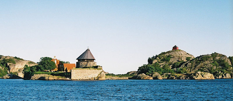
Staverns Fortress, Larvik

Gallery (4)
Map

Map
Gallery
Facts and practical information
Staverns Fortress was a military facility located on the island of Citadelløya at Stavern in Vestfold, Norway. ()
Address
Larvik
ContactAdd
Social media
Add
Getting there by public transportation
Public transportation stops near this location
- Bus
- Ferry
 Bus
Bus
- Calculate routeDampskipskaia 9 min walk
- Calculate routeStavern 12 min walk
- Calculate routeKastanjene 15 min walk
- Calculate routeAusrød 17 min walk
- Calculate routeMinnehallveien 19 min walk
Day trips


Frequently Asked Questions (FAQ)
How to get to Staverns Fortress by public transport?
The nearest stations to Staverns Fortress:
Ferry
Bus
Ferry
- Dampskipskaia (9 min walk)
Bus
- Stavern • Lines: 01 (12 min walk)
- Kastanjene • Lines: 01 (15 min walk)