Hornstranda, Oslo

Gallery (1)
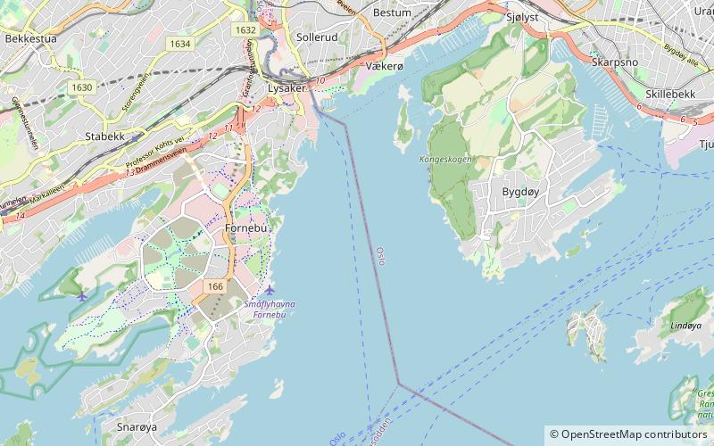
Map
Map
Facts and practical information
Hornstranda is a place located in Oslo (Akershus county) and belongs to the category of beach.
It is situated at an altitude of 30 feet, and its geographical coordinates are 59°52'6"N latitude and 10°39'18"E longitude.
Planning a visit to this place, one can easily and conveniently get there by public transportation. Hornstranda is a short distance from the following public transport stations: Nesoddtangen (bus, 5 min walk), Nesoddtangen (ferry, 6 min walk).
Among other places and attractions worth visiting in the area are: Fornebu, Bærum (neighbourhood, 44 min walk), Nakholmen (island, 51 min walk), Huk (beach, 51 min walk).
Coordinates: 59°52'6"N, 10°39'18"E
Address
Oslo
ContactAdd
Social media
Add
Getting there by public transportation
Public transportation stops near this location
- Bus
- Ferry
 Bus
Bus
- Calculate routeNesoddtangen 5 min walk
- Calculate routeNesoddtangen 6 min walk
- Calculate routeSjøstrand 30 min walk
Day trips


Frequently Asked Questions (FAQ)
How to get to Hornstranda by public transport?
The nearest stations to Hornstranda:
Bus
Ferry
Bus
- Nesoddtangen (5 min walk)
Ferry
- Nesoddtangen (6 min walk)
- Sjøstrand (30 min walk)