Ladeanlegget, Trondheim
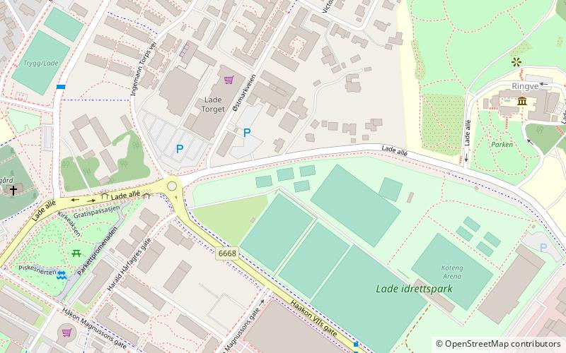
Map
Facts and practical information
Ladeanlegget is an outdoor sports complex in Trondheim consisting of several football pitches. Ladeanlegget is owned by Freidig SK but is located in the neighborhood of Lade and is the home field of Sportsklubben Trygg/Lade, while Freidig SK is based in the neighborhood of Eberg. ()
Coordinates: 63°26'47"N, 10°26'48"E
Address
Trondheim
ContactAdd
Social media
Add
Getting there by public transportation
Public transportation stops near this location
- Bus
- Train
 Bus
Bus
- Calculate routeIngemann Torps vei 4 min walk
- Calculate routeLade idrettsanlegg 5 min walk
- Calculate routeLade gård 6 min walk
- Calculate routeRingve skole 6 min walk
- Calculate routeLilleby 17 min walk
- Calculate routeLeangen 20 min walk
- Calculate routeLademoen 29 min walk
- Calculate routeRotvoll 32 min walk
Day trips


Frequently Asked Questions (FAQ)
Which popular attractions are close to Ladeanlegget?
Nearby attractions include Lade Mansion, Trondheim (5 min walk), Ringve Museum, Trondheim (7 min walk), Lade, Trondheim (7 min walk), Lade Church, Trondheim (7 min walk).
How to get to Ladeanlegget by public transport?
The nearest stations to Ladeanlegget:
Bus
Train
Bus
- Ingemann Torps vei • Lines: 2, 2 Strindheim - Lade - Sentrum - (4 min walk)
- Lade idrettsanlegg • Lines: 2, 2 Strindheim - Lade - Sentrum - (5 min walk)
Train
- Lilleby (17 min walk)
- Leangen (20 min walk)