Legarda Street, Manila
Map
Map

Facts and practical information
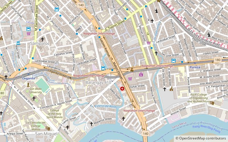
Legarda Street is a short street located in Sampaloc district in Manila, Philippines. It crosses through the eastern section of the University Belt area in a generally east–west orientation between the Nagtahan Interchange and the intersection with Nepomuceno Street in Quiapo. It is served by Legarda station of LRT Line 2. ()
Length: 4593 ftCoordinates: 14°36'4"N, 120°59'56"E
Day trips
Legarda Street – popular in the area (distance from the attraction)
Nearby attractions include: Malacañang Palace, Our Lady of Montserrat Abbey, San Sebastian Church, Mabini Shrine.
Frequently Asked Questions (FAQ)
Which popular attractions are close to Legarda Street?
Nearby attractions include San Miguel, Manila (3 min walk), Nagtahan Interchange, Manila (4 min walk), Sampaloc, Manila (7 min walk), St. Jude Parish, Manila (9 min walk).
How to get to Legarda Street by public transport?
The nearest stations to Legarda Street:
Bus
Metro
Train
Ferry
Light rail
Bus
- Nagtahan Rotonda • Lines: T310 (1 min walk)
- Raymond Transportation - Sampaloc Terminal (2 min walk)
Metro
- Pureza • Lines: 2 (11 min walk)
- Legarda • Lines: 2 (12 min walk)
Train
- Santa Mesa (20 min walk)
- España (20 min walk)
Ferry
- Pup • Lines: Pasig River Ferry (22 min walk)
- Lawton • Lines: Pasig River Ferry (32 min walk)
Light rail
- Doroteo Jose • Lines: 1 (30 min walk)
- Central Terminal • Lines: 1 (34 min walk)

