Broadway Centrum, Quezon City
Map
Facts and practical information
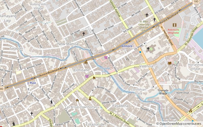
Broadway Centrum was a television studio complex located in the New Manila district of Quezon City at Aurora Boulevard cor. Broadway Avenue, Quezon City. It is currently owned by the Empire East Land Holdings, a subsidiary of Megaworld Corporation. It was previously owned by GMA Network. ()
Coordinates: 14°36'42"N, 121°1'55"E
Address
Quezon City District 4 (Valencia)Quezon City
ContactAdd
Social media
Add
Getting there by public transportation
Public transportation stops near this location
- Metro
- Bus
 Metro
Metro
- Calculate routeGilmore 5 min walk
- Calculate routeJ. Ruiz 11 min walk
- Calculate routeBetty Go - Belmonte 22 min walk
- Calculate routeV. Mapa 29 min walk
- Calculate routeGilmore Avenue 6 min walk
- Calculate routeRobinsons Magnolia 10 min walk
- Calculate routeAbad Santos 15 min walk
- Calculate routeSantolan Road 16 min walk
Day trips


Frequently Asked Questions (FAQ)
Which popular attractions are close to Broadway Centrum?
Nearby attractions include Granada Street, Quezon City (10 min walk), Gilmore Avenue, Quezon City (11 min walk), Juan Ruiz Street, San Juan (12 min walk), Pinaglabanan Church, San Juan (12 min walk).
How to get to Broadway Centrum by public transport?
The nearest stations to Broadway Centrum:
Metro
Bus
Metro
- Gilmore • Lines: 2 (5 min walk)
- J. Ruiz • Lines: 2 (11 min walk)
Bus
- Gilmore Avenue • Lines: 11, Qc6 (6 min walk)
- Robinsons Magnolia • Lines: 10 (10 min walk)