Pureza Street, Manila
Map
Facts and practical information
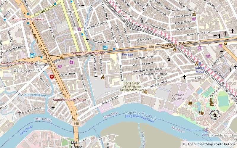
Pureza Street is a short street located in Santa Mesa district in Manila, Philippines. It is a notable road in a generally north-south orientation between the junction with Paltok Street and San Jose Street in Santa Mesa and the intersection with Anonas Street also in Santa Mesa. It is served by Pureza Station of the Manila Line 2. ()
Coordinates: 14°36'0"N, 121°0'16"E
Address
Santa MesaManila
ContactAdd
Social media
Add
Getting there by public transportation
Public transportation stops near this location
- Metro
- Bus
- Train
- Ferry
 Metro
Metro
- Calculate routePureza 4 min walk
- Calculate routeLegarda 21 min walk
- Calculate routeV. Mapa 23 min walk
- Calculate routePureza 4 min walk
- Calculate routeAB Liner - Sampaloc Terminal 4 min walk
- Calculate routeRamon Magsaysay-Vicente Cruz 5 min walk
- Calculate routeLardizabal 7 min walk
- Calculate routeSanta Mesa 11 min walk
- Calculate routePandacan 19 min walk
- Calculate routeEspaña 26 min walk
- Calculate routeLaon Laan 36 min walk
- Calculate routePup 13 min walk
- Calculate routeLambingan 33 min walk
Day trips


Frequently Asked Questions (FAQ)
Which popular attractions are close to Pureza Street?
Nearby attractions include Nagtahan Interchange, Manila (7 min walk), Sampaloc, Manila (7 min walk), San Miguel, Manila (8 min walk), Magsaysay Boulevard, Manila (9 min walk).
How to get to Pureza Street by public transport?
The nearest stations to Pureza Street:
Metro
Bus
Train
Ferry
Metro
- Pureza • Lines: 2 (4 min walk)
- Legarda • Lines: 2 (21 min walk)
Bus
- Pureza • Lines: 10, 306 (4 min walk)
- AB Liner - Sampaloc Terminal (4 min walk)
Train
- Santa Mesa (11 min walk)
- Pandacan (19 min walk)
Ferry
- Pup • Lines: Pasig River Ferry (13 min walk)
- Lambingan • Lines: Pasig River Ferry (33 min walk)