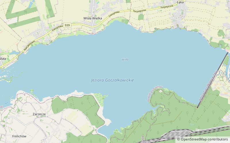
Goczałkowice Reservoir

Gallery (1)
Map
Map
Facts and practical information
Goczałkowice Reservoir is an artificial water reservoir close to Goczałkowice-Zdrój in the Silesian Voivodeship in Poland created with a dam on the Vistula in 1956. The area of the reservoir is 32 square kilometres and its capacity is 168 million m³. It is around 75 kilometres west of Kraków. ()
Local name: Jezioro Goczałkowickie Built: 1956 (70 years ago)Area: 12.36 mi²Elevation: 823 ft a.s.l.Coordinates: 49°55'46"N, 18°51'59"E
Location
Silesian
ContactAdd
Social media
Add
Day trips