SGGW, Warsaw
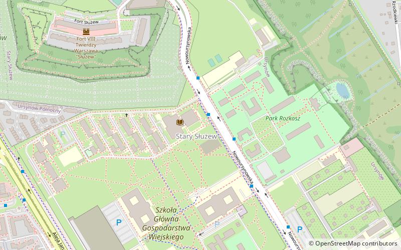
Map
Facts and practical information
The Warsaw University of Life Sciences is the largest agricultural university in Poland, established in 1816 in Warsaw. It employs over 2,600 staff including over 1,200 academic educators. The University is since 2005 a member of the Euroleague for Life Sciences which was established in 2001. The SGGW offers some 37 different fields of study, 13 faculties in Agricultural Sciences, Economic Sciences, Humanities, Technical as well as Life Sciences ()
Getting there by public transportation
Public transportation stops near this location
- Metro
- Bus
- Tram
 Metro
Metro
- Calculate routeSGGW-Biblioteka 01 1 min walk
- Calculate routeSGGW-Rektorat 01 4 min walk
- Calculate routeStokłosy 19 min walk
- Calculate routeUrsynów 20 min walk
- Calculate routeSłużew 26 min walk
- Calculate routeImielin 27 min walk
- Calculate routeAleja Lotników 07 32 min walk
- Calculate routeNiedźwiedzia 04 35 min walk
Day trips
SGGW – popular in the area (distance from the attraction)
Nearby attractions include: Museum of Polish Military Technology, Museum of John Paul II and Primate Wyszyński, Muzeum Historii Polskiego Ruchu Ludowego, Temple of Divine Providence.


Frequently Asked Questions (FAQ)
Which popular attractions are close to SGGW?
Nearby attractions include St Catherine's Church, Warsaw (15 min walk), Stokłosy, Warsaw (16 min walk), Vistula University, Warsaw (16 min walk), Służew, Warsaw (21 min walk).
How to get to SGGW by public transport?
The nearest stations to SGGW:
Bus
Metro
Tram
Bus
- SGGW-Biblioteka 01 • Lines: 148, 166, 193, 401 (1 min walk)
- SGGW-Rektorat 01 • Lines: 148, 166, 193, 401 (4 min walk)
Metro
- Stokłosy • Lines: M1 (19 min walk)
- Ursynów • Lines: M1 (20 min walk)
Tram
- Aleja Lotników 07 • Lines: 10, 35, 4 (32 min walk)
- Niedźwiedzia 04 • Lines: 10, 35, 4 (35 min walk)