Tmutarakan, Taman
Map

Map

Facts and practical information
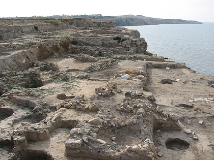
Tmutarakan was a medieval Kievan Rus' principality and trading town that controlled the Cimmerian Bosporus, the passage from the Black Sea to the Sea of Azov, between the late 10th and 11th centuries. Its site was the ancient Greek colony of Hermonassa founded in the mid 6th century BCE, by Mytilene, situated on the Taman peninsula, in the present-day Krasnodar Krai of Russia, roughly opposite Kerch. The Khazar fortress of Tamantarkhan was built on the site in the 7th century, and became known as Tmutarakan when it came under Kievan Rus control. ()
Local name: Тмутаракань Built: VI century B.C.Abandoned: XIV centuryCoordinates: 45°13'9"N, 36°42'51"E
Address
Taman
ContactAdd
Social media
Add
Day trips
Tmutarakan – popular in the area (distance from the attraction)
Nearby attractions include: Ataman.

