Ligovsky overpass, Saint Petersburg
Map

Map

Facts and practical information
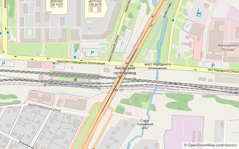
Ligovsky overpass is crossover, connect of Kirovsky and Krasnoselsky districts of Saint Petersburg through Prospekt Narodnogo Opolcheniya, stage tracks Ligovo-Dachnoye and Dudergofka river. ()
Coordinates: 59°49'24"N, 30°11'3"E
Address
Saint Petersburg
ContactAdd
Social media
Add
Day trips
Ligovsky overpass – popular in the area (distance from the attraction)
Nearby attractions include: Strelna, Pulkovo Observatory, Chesme Church, Narva Triumphal Arch.
Frequently Asked Questions (FAQ)
How to get to Ligovsky overpass by public transport?
The nearest stations to Ligovsky overpass:
Train
Bus
Tram
Trolleybus
Train
- Лигово (3 min walk)
Bus
- железнодорожная станция Лигово • Lines: 111, 130, 163, 165, 2, 2А, 87 (4 min walk)
- Проспект Маршала Жукова (7 min walk)
Tram
- Авангардная улица • Lines: 52 (18 min walk)
- улица Партизана Германа • Lines: 52 (19 min walk)
Trolleybus
- Авангардная улица • Lines: 20, 37, 44, 46, 48 (18 min walk)
- улица Партизана Германа • Lines: 37, 46, 48 (18 min walk)

 Metro
Metro


