Jungnang District, Seoul

Gallery (1)
Map

Map
Facts and practical information
Jungnang District is one of the 25 gu, or districts, of Seoul, South Korea. It is located on the north side of the Han River. ()
Getting there by public transportation
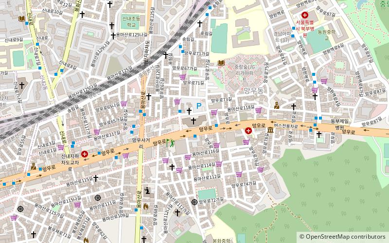
Public transportation stops near this location
- Metro
- Bus
 Metro
Metro
- Calculate routeMangu 13 min walk
- Calculate route신내 19 min walk
- Calculate routeSangbong Terminal 18 min walk
- Calculate routeSin An apt. ent 22 min walk
Maps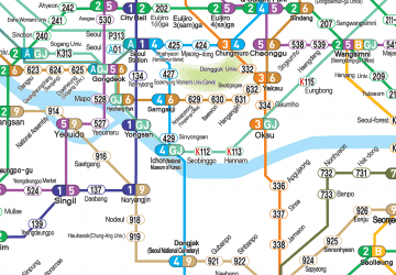 Metro
Metro
MetroDay trips


Frequently Asked Questions (FAQ)
How to get to Jungnang District by public transport?
The nearest stations to Jungnang District:
Metro
Bus
Metro
- Mangu • Lines: G·j, Gc, 경춘선 (13 min walk)
- 신내 • Lines: 6, Gc, 경춘선 (19 min walk)
Bus
- Sangbong Terminal (18 min walk)
- Sin An apt. ent (22 min walk)