Kumnan Methodist Church, Seoul
Map
Facts and practical information
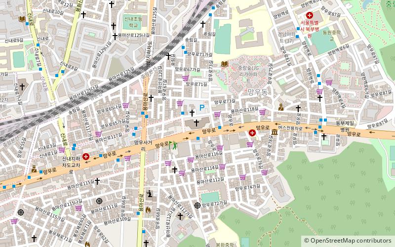
Kumnan Methodist Church is the Korean Methodist Church-affiliated church in Jungnang-gu, Mangu-dong in Seoul, South Korea. Kumnan Methodist church, the registered church members are 140,000, is known as the world's largest Methodist church. The 19th World Methodist Conference was held in the Kumnan Methodist Church. ()
Address
중랑구 (망우본동)Seoul
ContactAdd
Social media
Add
Getting there by public transportation
Public transportation stops near this location
- Metro
- Bus
 Metro
Metro
- Calculate route양원 13 min walk
- Calculate routeYangwon 13 min walk
- Calculate routeMangu 16 min walk
- Calculate routeSangbong Terminal 16 min walk
- Calculate routeSin An apt. ent 39 min walk
Maps Metro
Metro
MetroDay trips


Frequently Asked Questions (FAQ)
How to get to Kumnan Methodist Church by public transport?
The nearest stations to Kumnan Methodist Church:
Metro
Bus
Metro
- 양원 • Lines: G·j (13 min walk)
- Yangwon • Lines: G·j (13 min walk)
Bus
- Sangbong Terminal (16 min walk)
- Sin An apt. ent (39 min walk)