31 Building, Seoul
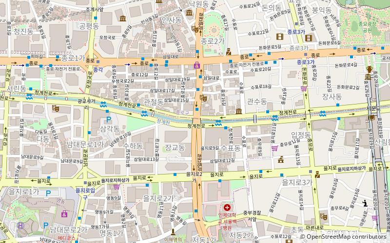
Map
Facts and practical information
31 Building is an office building in Seoul, South Korea. Completed in 1970, the 31 Building was the tallest building in Seoul until 1979, when Lotte Hotel Seoul was completed. ()
Address
중구 (jung-gu)Seoul
ContactAdd
Social media
Add
Getting there by public transportation
Public transportation stops near this location
- Metro
- Bus
- Train
 Metro
Metro
- Calculate routeJongno 2 Ga 4 min walk
- Calculate routeCentral Cinema Baek Hospital 6 min walk
- Calculate routeEuljiro Entrance Yeokgwanggyo 8 min walk
- Calculate routeEuljiro 3-ga 8 min walk
- Calculate routeJonggak 8 min walk
- Calculate routeEuljiro 1-ga 8 min walk
- Calculate routeJongno 3-ga 8 min walk
- Calculate routeSeoul 34 min walk
Maps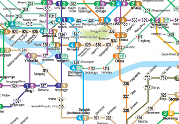 Metro
Metro
MetroDay trips


Frequently Asked Questions (FAQ)
Which popular attractions are close to 31 Building?
Nearby attractions include Samgak-dong, Seoul (5 min walk), Tapgol Park, Seoul (6 min walk), Wongaksa Pagoda, Seoul (7 min walk), Bosingak, Seoul (7 min walk).
How to get to 31 Building by public transport?
The nearest stations to 31 Building:
Bus
Metro
Train
Bus
- Jongno 2 Ga • Lines: 9300, M4101 (4 min walk)
- Central Cinema Baek Hospital • Lines: 9300, M4101 (6 min walk)
Metro
- Euljiro 3-ga • Lines: 2, 3 (8 min walk)
- Jonggak • Lines: 1 (8 min walk)
Train
- Seoul (34 min walk)