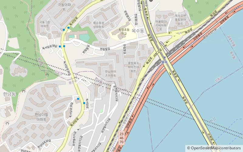
Oksu-dong, Seoul
Map
Facts and practical information
Oksu-dong is a dong, of Seongdong-gu in Seoul, South Korea. ()
Address
성동구 (옥수동)Seoul
ContactAdd
Social media
Add
Getting there by public transportation
Public transportation stops near this location
- Metro
- Bus
 Metro
Metro
- Calculate routeOksu 6 min walk
- Calculate route옥수 6 min walk
- Calculate routeGeumho 16 min walk
- Calculate route한강진 19 min walk
- Calculate route순천향대학병원앞 15 min walk
- Calculate route압구정파출소 35 min walk
- Calculate routeSingu Middle School 35 min walk
- Calculate routeEungbong Station 36 min walk
Maps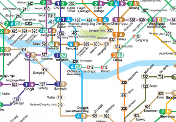 Metro
Metro
MetroDay trips


Frequently Asked Questions (FAQ)
Which popular attractions are close to Oksu-dong?
Nearby attractions include Dongho Bridge, Seoul (10 min walk), Hannam-dong, Seoul (13 min walk), Hannam Bridge, Seoul (21 min walk), Royal Tombs of the Joseon Dynasty, Seoul (22 min walk).
How to get to Oksu-dong by public transport?
The nearest stations to Oksu-dong:
Metro
Bus
Metro
- Oksu • Lines: 3, G·j (6 min walk)
- 옥수 • Lines: G·j (6 min walk)
Bus
- 순천향대학병원앞 • Lines: 9300 (15 min walk)
- 압구정파출소 • Lines: 342 (35 min walk)