Sant Gregori
#661 among destinations in Spain
![Sant Gregori location map](https://tzmedia.b-cdn.net/media/images/static-maps/es/41_9646_2_5711.jpg)
Facts and practical information
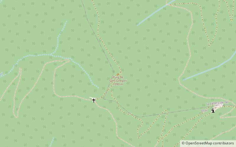
Sant Gregori is a mountain of the Guilleries Massif, Catalonia, Spain. It has an elevation of 1,090.8 metres above sea level. ()
CataloniaSpain
Sant Gregori plan & book
Unleash the traveler in you — discover the cheapest flight deals, find the perfect hotel or hostel nearby, and search for the best car rental prices. Travel at your own pace to discover new places and enjoy your journey.
Sant Gregori – popular in the area (distance from the attraction)
Nearby attractions include: el Far, Santa Maria, Sant Miquel de Solterra, L'Agullola.
4.3 miNWNature, Natural attraction, Mountainel Far
110 min walk • Nestled in the rugged terrain of Catalonia, Spain, El Far is a mountain that offers more than just stunning vistas; it's a spiritual retreat and a beacon of tranquility. The mountain, whose name means "The Lighthouse" in Catalan, is not only a geographical landmark but...
3.5 miNEMonasterySanta Maria
90 min walk • Santa Maria d'Amer is a Benedictine monastery in Amer, Selva, Catalonia, Spain.
3.5 miSWNature, Natural attraction, MountainSant Miquel de Solterra
89 min walk • Sant Miquel de Solterra or Sant Miquel de les Formigues is the highest mountain of the Guilleries Massif, Catalonia, Spain. It has an elevation of 1,201.9 metres above sea level.
5.3 miNWNature, Natural attraction, MountainL'Agullola, Rupit
135 min walk • L'Agullola is a mountain of the Guilleries Massif, Catalonia, Spain. It has an elevation of 921.9 metres above sea level. The plateau known as Pla de Fàbregues lies NW of the summit.
3.2 miWNature, Natural attraction, MountainSant Benet
81 min walk • Sant Benet is a mountain of the Guilleries Massif, Catalonia, Spain. It has an elevation of 1,146.9 metres above sea level.
2.1 miNEDamPasteral Reservoir
53 min walk • Pasteral Reservoir is a reservoir located on the Ter river, on the border between La Cellera de Ter and Amer, Catalonia, Spain. The reservoir has a storage capacity of 233 hm³ and the dam has a structural height of 33 m and a crest length of 150 m.
4.8 miWNature, Natural attraction, MountainMontdois
122 min walk • Montdois is a mountain of the Guilleries Massif, Catalonia, Spain. It has an elevation of 928.1 metres above sea level.
5.6 miNENature, Cliff, Natural attractionSant Roc d'Amer
144 min walk • Sant Roc, also known as Sant Roc d'Amer, Sant Roc de la Barroca and Grony, is a mountain of the Catalan Transversal Range, Catalonia, Spain. It has an elevation of 591 metres above sea level.
3.5 miELocalityAnglès
89 min walk • One of the town's main attractions is the medieval Sant Esteve church, a beautiful example of Catalan Gothic architecture. Visitors can explore the church's interior, which features intricate stone carvings and stunning stained glass windows.
5.1 miELocalitySant Julià del Llor i Bonmatí
131 min walk • Sant Julià del Llor i Bonmatí is a municipality in the comarca of la Selva in Catalonia, Spain.