[[La Garajonay National Park|Garajonay National Park]], La Garajonay National Park
![[[La Garajonay National Park|Garajonay National Park]]](https://tzmedia.b-cdn.net/media/images/es/place/800/80b38a25fb79bc8d1add9d60da6e1083.jpg?1582270511)
Gallery (1)
Map
![[[La Garajonay National Park|Garajonay National Park]] location map](https://tzmedia.b-cdn.net/media/images/static-maps/es/28_1301_-17_2476.jpg)
Map
Facts and practical information
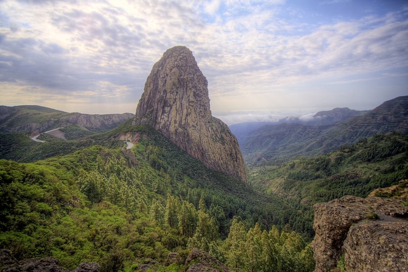
Garajonay National Park is located in the center and north of the island of La Gomera, one of the Canary Islands. It was declared a national park in 1981 and a World Heritage Site by UNESCO in 1986. It occupies 40 km2 and it extends into each of the six municipalities on the island. ()
Local name: Parque nacional de Garajonay Established: 1981 (45 years ago)Unesco: from 1986Area: 15.25 mi²Elevation: 3730 ft a.s.l.Coordinates: 28°7'48"N, 17°14'51"W
Address
La Garajonay National Park
ContactAdd
Social media
Add
Day trips