Norr Mälarstrand, Stockholm
Map

Map

Facts and practical information
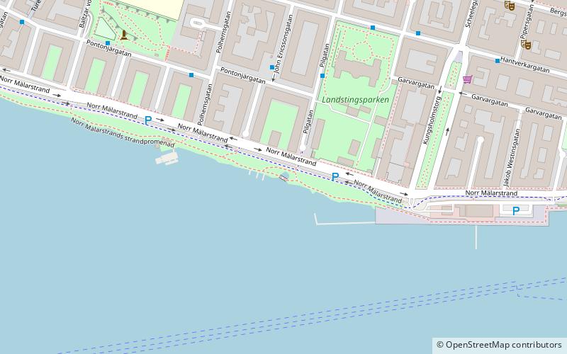
Norr Mälarstrand is a street on Kungsholmen in central Stockholm, Sweden. Bordering Riddarfjärden, the easternmost bay of Lake Mälaren, Norr Mälarstrand is a southbound boulevard stretching 1,4 km west from the Stockholm City Hall to the southern end of the street Sankt Eriksgatan. The most notable structures along the street are the series of functionalist residential buildings lined-up along its western part. The park facing the waterfront south of the street is popular for walks. ()
Address
Kungsholmen (Kungsholm)Stockholm
ContactAdd
Social media
Add
Day trips
Norr Mälarstrand – popular in the area (distance from the attraction)
Nearby attractions include: Stockholm City Hall, Västermalmsgallerian, Stadshusbron, Smedsuddsbadet.
Frequently Asked Questions (FAQ)
Which popular attractions are close to Norr Mälarstrand?
Nearby attractions include Stockholm Court House, Stockholm (9 min walk), Rålambshovsparken, Stockholm (10 min walk), Kungsholmen, Stockholm (11 min walk), Kungsholm Church, Stockholm (11 min walk).
How to get to Norr Mälarstrand by public transport?
The nearest stations to Norr Mälarstrand:
Bus
Metro
Ferry
Train
Tram
Bus
- Pilgatan • Lines: 61 (3 min walk)
- John Ericssonsgatan • Lines: 61 (4 min walk)
Metro
- Rådhuset • Lines: 10, 11 (9 min walk)
- Fridhemsplan • Lines: 10, 11, 17, 18, 19 (14 min walk)
Ferry
- Klara Mälarstrand • Lines: 89 (19 min walk)
- Riddarholmen • Lines: Båt (22 min walk)
Train
- Stockholms central (19 min walk)
- Stockholm City (21 min walk)
Tram
- T-Centralen • Lines: 7 (24 min walk)
- Trekanten • Lines: 30 (29 min walk)

 Metro
Metro Rail network map


