Alviksbron, Stockholm
Map

Map

Facts and practical information
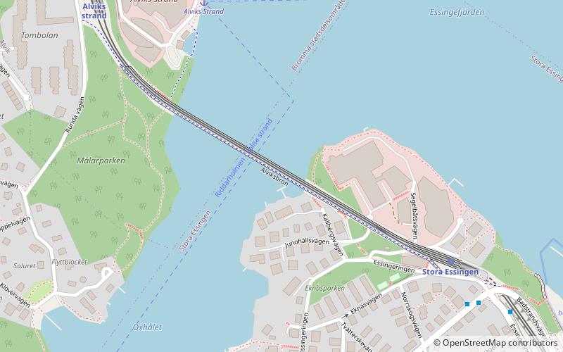
Alviksbron is a box girder bridge in central Stockholm, Sweden. Stretching over Oxhålssundet, it connects Stora Essingen island to the western suburb Bromma. Built 1996-1998 by the Nordic Construction Company at a cost of 180 million SEK, it has served the Tvärbanan light rail line and pedestrians and bicyclists since its inauguration in August 2000. The name is derived from Alvik, originally a local manor house built in 1819 and demolished in 1930. ()
Address
Stockholm
ContactAdd
Social media
Add
Day trips
Alviksbron – popular in the area (distance from the attraction)
Nearby attractions include: Lillsjön, Smedsuddsbadet, Café Solviksbadet, Trekanten.
Frequently Asked Questions (FAQ)
Which popular attractions are close to Alviksbron?
Nearby attractions include Stora Essingen, Stockholm (9 min walk), Essingebron, Stockholm (10 min walk), Tranebergsbron, Stockholm (13 min walk), Alvik, Stockholm (13 min walk).
How to get to Alviksbron by public transport?
The nearest stations to Alviksbron:
Tram
Ferry
Bus
Metro
Light rail
Tram
- Stora Essingen • Lines: 30 (6 min walk)
- Alviks strand • Lines: 30 (8 min walk)
Ferry
- Alviks Strand • Lines: Båt (6 min walk)
- Ekensberg • Lines: 89 (19 min walk)
Bus
- Broparken • Lines: 1, 56, 91 (7 min walk)
- Flottbrovägen • Lines: 1, 56, 91 (7 min walk)
Metro
- Alvik • Lines: 17, 18, 19 (14 min walk)
- Kristineberg • Lines: 17, 18, 19 (19 min walk)
Light rail
- Johannesfred • Lines: 30, 31 (34 min walk)

 Metro
Metro Rail network map


