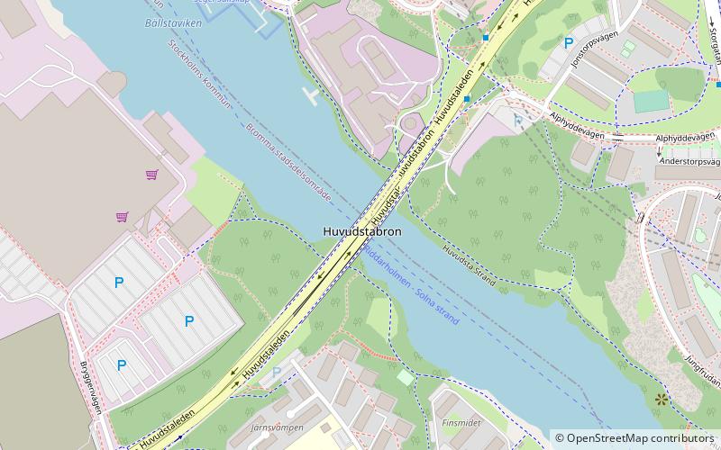
Huvudstabron, Stockholm

Gallery (1)
Map
Map
Facts and practical information
Getting there by public transportation
Public transportation stops near this location
- Metro
- Bus
- Tram
- Light rail
- Train
- Ferry
 Metro
Metro
- Calculate routeSolna strand 9 min walk
- Calculate routeVoltavägen 8 min walk
- Calculate routeSolna Strand 8 min walk
- Calculate routeHornsbergs Strand 35 min walk
- Calculate routeSolna strand 8 min walk
- Calculate routeHuvudsta 13 min walk
- Calculate routeSundbybergs centrum 19 min walk
- Calculate routeSolna centrum 28 min walk
- Calculate routeNorra Ulvsunda 10 min walk
- Calculate routeJohannesfred 14 min walk
- Calculate routeJohannesfred 14 min walk
- Calculate routeKarlsbodavägen 15 min walk
- Calculate routeSolna Business Park 18 min walk
- Calculate routeSundbybergs centrum 20 min walk
- Calculate routeSundbyberg 19 min walk
Maps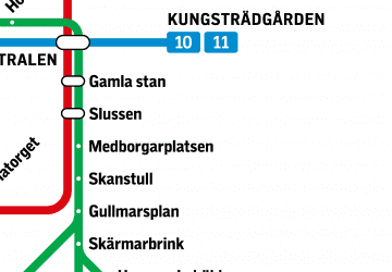 MetroMaps
 Rail network map
MetroMapsRail network mapDay trips


Frequently Asked Questions (FAQ)
Which popular attractions are close to Huvudstabron?
Nearby attractions include Ulvsunda Castle, Stockholm (18 min walk), Lillsjön, Stockholm (22 min walk).
How to get to Huvudstabron by public transport?
The nearest stations to Huvudstabron:
Bus
Ferry
Metro
Light rail
Tram
Train
Bus
- Solna strand • Lines: 156, 176, 177, 302, 512 (9 min walk)
- Voltavägen • Lines: 176, 177, 302, Flygbussarna (8 min walk)
Ferry
- Solna Strand • Lines: Båt (8 min walk)
- Hornsbergs Strand • Lines: Båt (35 min walk)
Metro
- Solna strand • Lines: 10 (8 min walk)
- Huvudsta • Lines: 10 (13 min walk)
Light rail
- Norra Ulvsunda • Lines: 30, 31 (10 min walk)
- Johannesfred • Lines: 30, 31 (14 min walk)
Tram
- Johannesfred • Lines: 30 (14 min walk)
- Karlsbodavägen • Lines: 30 (15 min walk)
Train
- Sundbyberg (19 min walk)