Bromma, Stockholm
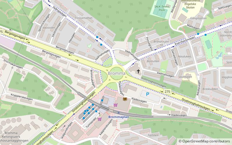
Map
Facts and practical information
Bromma is a borough in the western part of Stockholm, Sweden, forming part of the Stockholm Municipality. Bromma is primarily made up of Bromma Parish and Västerled Parish. The fourth largest airport in Sweden and the third largest of the airports close to Stockholm, the Stockholm Bromma Airport, was first built in Bromma in 1936. The south-eastern part of Bromma is one of the richest areas in Stockholm. ()
Getting there by public transportation
Public transportation stops near this location
- Metro
- Bus
- Tram
- Light rail
- Ferry
 Metro
Metro
- Calculate routeVadmalsvägen 3 min walk
- Calculate routeBrommaplan 3 min walk
- Calculate routeRiksbyvägen 7 min walk
- Calculate routeSalixvägen 8 min walk
- Calculate routeBrommaplan 3 min walk
- Calculate routeAbrahamsberg 15 min walk
- Calculate routeÅkeshov 15 min walk
- Calculate routeStora mossen 26 min walk
- Calculate routeOlovslund 22 min walk
- Calculate routeNockeby torg 22 min walk
- Calculate routeNockeby 28 min walk
- Calculate routeJohannesfred 28 min walk
- Calculate routeNorra Ulvsunda 28 min walk
- Calculate routeJohannesfred 28 min walk
- Calculate routeSolna Strand 37 min walk
Maps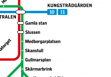 MetroMaps
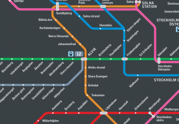 Rail network map
MetroMapsRail network mapDay trips


Frequently Asked Questions (FAQ)
Which popular attractions are close to Bromma?
Nearby attractions include Brommaplan, Stockholm (3 min walk), Åkeslund, Stockholm (7 min walk), Åkeshov Castle, Stockholm (14 min walk), Abrahamsberg, Stockholm (16 min walk).
How to get to Bromma by public transport?
The nearest stations to Bromma:
Bus
Metro
Tram
Light rail
Ferry
Bus
- Vadmalsvägen • Lines: 117 (3 min walk)
- Brommaplan • Lines: 117, 127, 129, 155, 176, 177, 198, 301, 302, 303, 305, 309, 311, 312, 317, 322, 323, 336, 338, 396, Flygbussarna (3 min walk)
Metro
- Brommaplan • Lines: 17, 19 (3 min walk)
- Abrahamsberg • Lines: 17, 19 (15 min walk)
Tram
- Olovslund • Lines: 12 (22 min walk)
- Nockeby torg • Lines: 12 (22 min walk)
Light rail
- Norra Ulvsunda • Lines: 30, 31 (28 min walk)
- Johannesfred • Lines: 30, 31 (28 min walk)
Ferry
- Solna Strand • Lines: Båt (37 min walk)