Tullgränd, Stockholm

Gallery (1)
Map

Map
Facts and practical information
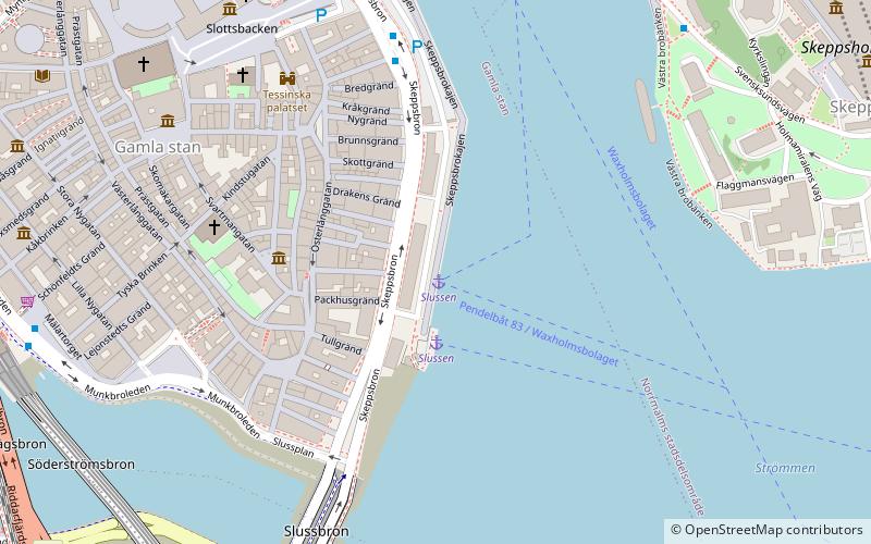
Tullgränd is an alley in Gamla stan, the old town of Stockholm, Sweden, connecting Skeppsbron to Österlånggatan. It forms a parallel street to Packhusgränd and Norra Bankogränd. ()
Address
Södermalm (Storkyrkan)Stockholm
ContactAdd
Social media
Add
Getting there by public transportation
Public transportation stops near this location
- Metro
- Bus
- Tram
- Train
- Ferry
 Metro
Metro
- Calculate routeSlussen 2 min walk
- Calculate routeStrömkajen 12 min walk
- Calculate routeRiddarholmen 12 min walk
- Calculate routeSkeppsholmen 14 min walk
- Calculate routeSlottsbacken 6 min walk
- Calculate routeMälartorget 6 min walk
- Calculate routeSlussen 7 min walk
- Calculate routeGamla stan 7 min walk
- Calculate routeSlussen 7 min walk
- Calculate routeMedborgarplatsen 14 min walk
- Calculate routeKungsträdgården 15 min walk
- Calculate routeNybroplan 18 min walk
- Calculate routeStyrmansgatan 18 min walk
- Calculate routeKungsträdgården 18 min walk
- Calculate routeT-Centralen 20 min walk
- Calculate routeStockholms central 24 min walk
- Calculate routeStockholms södra 21 min walk
- Calculate routeStockholm City 22 min walk
Maps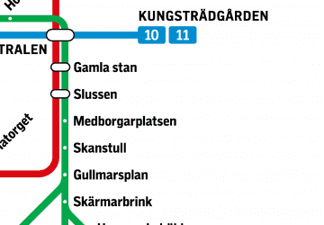 MetroMaps
 Rail network map
MetroMapsRail network mapDay trips


Frequently Asked Questions (FAQ)
Which popular attractions are close to Tullgränd?
Nearby attractions include Norra Bankogränd, Stockholm (1 min walk), Packhusgränd, Stockholm (1 min walk), Österlånggatan, Stockholm (1 min walk), Black Friars' Monastery of Stockholm, Stockholm (1 min walk).
How to get to Tullgränd by public transport?
The nearest stations to Tullgränd:
Ferry
Bus
Metro
Tram
Train
Ferry
- Slussen • Lines: 18, 24, 82 (2 min walk)
- Strömkajen • Lines: 12, 13, 14, 18, 24, 8, 9, Royal Canal Tour (12 min walk)
Bus
- Slottsbacken • Lines: 190, 191, 192, 193, 194, 195, 2, 57, 76, 96 (6 min walk)
- Mälartorget • Lines: 3, 53 (6 min walk)
Metro
- Gamla stan • Lines: 13, 14, 17, 18, 19 (7 min walk)
- Slussen • Lines: 13, 14, 17, 18, 19 (7 min walk)
Tram
- Nybroplan • Lines: 7 (18 min walk)
- Styrmansgatan • Lines: 7 (18 min walk)
Train
- Stockholms central (24 min walk)
- Stockholms södra (21 min walk)