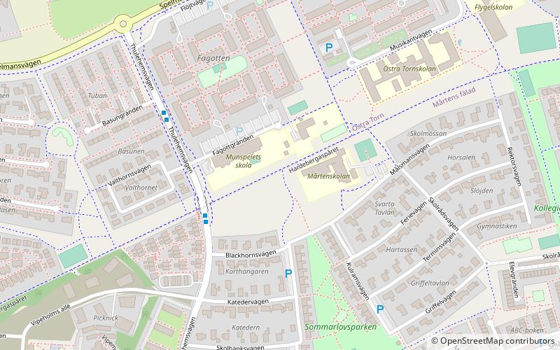
Östra Torn, Lund
Map
Facts and practical information
Östra Torn, roughly translated as "Eastern Tower", is an eastern city-district in the Swedish town of Lund. ()
Address
Lund
ContactAdd
Social media
Add
Getting there by public transportation
Public transportation stops near this location
- Bus
- Tram
 Bus
Bus
- Calculate routeLund Bläckhornsvägen 3 min walk
- Calculate routeLund Fagottgränden 4 min walk
- Calculate routeLund Thulehemsvägen 8 min walk
- Calculate routeLund Flygelvägen 9 min walk
- Calculate routeLund Telefonplan 17 min walk
- Calculate routeLund Solbjer 19 min walk
- Calculate routeIdeontorget 24 min walk
- Calculate routeLund Brunnshögstorget 25 min walk
Day trips


Frequently Asked Questions (FAQ)
Which popular attractions are close to Östra Torn?
Nearby attractions include Vattenhallen, Lund (24 min walk), Linero torg, Lund (24 min walk).
How to get to Östra Torn by public transport?
The nearest stations to Östra Torn:
Bus
Tram
Bus
- Lund Bläckhornsvägen • Lines: 159, 6 (3 min walk)
- Lund Fagottgränden • Lines: 159, 6 (4 min walk)
Tram
- Lund Telefonplan (17 min walk)
- Lund Solbjer (19 min walk)