Mont d'Or
#1148 among destinations in Switzerland
![Mont d'Or location map](https://tzmedia.b-cdn.net/media/images/static-maps/ch/46_3884_7_06017.jpg)
Facts and practical information
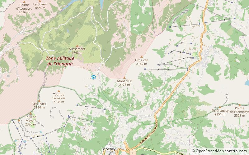
Mont d'Or is a mountain of the Bernese Alps of Switzerland, overlooking Le Sépey in the canton of Vaud. It lies on the range between the Lac de l'Hongrin and the valley of Ormont-Dessous, and flanks the Col des Mosses pass. ()
Le PontVaudSwitzerland
Mont d'Or plan & book
Unleash the traveler in you — discover the cheapest flight deals, find the perfect hotel or hostel nearby, and search for the best car rental prices. Travel at your own pace to discover new places and enjoy your journey.
Mont d'Or – popular in the area (distance from the attraction)
Nearby attractions include: Lac Lioson, Tour d'Aï, Pic Chaussy, Le Chamossaire.
3.3 miENature, Natural attraction, LakeLac Lioson, Les Diablerets
84 min walk • Lac Lioson is a lake in the municipality of Ormont-Dessous, near Les Mosses, in the canton of Vaud, Switzerland. Its surface area is 7 ha. The lake is used for fishing and ice diving.
3 miWPeak with hiking and lake viewsTour d'Aï
77 min walk • The Tour d'Aï is a mountain in the western Bernese Alps, overlooking Leysin in the canton of Vaud. It is located near the Tour de Mayen, on the range lying between the Rhone and Col des Mosses, south of Lake Geneva, from where both summits can be easily seen.
2.6 miENature, Natural attraction, MountainPic Chaussy, Les Diablerets
67 min walk • Pic Chaussy is a mountain of the Bernese Alps, overlooking Les Diablerets to the south. On its northern side lies the Lac Lioson, whilst the Col des Mosses pass flanks its western side.
4.5 miSNature, Natural attraction, MountainLe Chamossaire, Villars-sur-Ollon
115 min walk • Le Chamossaire is a mountain part of the Alpes Vaudoises, overlooking Villars-sur-Ollon on its south face and Les Ormonts valley on its north face. It is located in the canton of Vaud.
4 miSNature, Natural attraction, LakeLac des Chavonnes, Villars-sur-Ollon
102 min walk • Lac des Chavonnes is a lake in the municipality of Ormont-Dessous, above Villars-sur-Ollon, Vaud, Switzerland. Its surface area is 5 ha.
2.6 miWNature, Natural attraction, MountainTour de Mayen
68 min walk • The Tour de Mayen is a mountain of the Swiss Prealps, located north of Leysin in the canton of Vaud. It lies east of the Tour d'Aï, on the range lying between the lake of Hongrins and the valley of Ormont Dessous and Ormont Dessus.
3.4 miSWNature, Natural attraction, MountainBerneuse, Leysin
87 min walk • The Berneuse is a mountain of the western Bernese Alps, above Leysin in the canton of Vaud. It lies on the range east of the Rhone valley, culminating at the Tour d'Aï.
4.2 miENature, Natural attraction, MountainLe Tarent, Les Diablerets
107 min walk • Le Tarent is a mountain in the western Bernese Alps, overlooking Les Diablerets in the canton of Vaud. At 2,548 metres above sea level, it is the highest mountain of the range lying north of the Col du Pillon.
1.8 miWNature, Natural attraction, MountainTour de Famelon
46 min walk • The Tour de Famelon is a mountain of the Swiss Prealps, located north of Leysin in the canton of Vaud. It lies between the Tour de Mayen and the Pierre du Moëllé, on the range lying between the lake of Hongrin and the valley of Ormont Dessous and Ormont Dessus.
4.4 miENature, Natural attraction, MountainLa Para, Les Diablerets
113 min walk • La Para is a mountain of the western Bernese Alps, overlooking Les Diablerets in the canton of Vaud.
3.3 miNWNature, Natural attraction, MountainPointe d'Aveneyre
85 min walk • The Pointe d'Aveneyre is a mountain of the Swiss Prealps, located east of Villeneuve in the canton of Vaud. It lies south of the Rochers de Naye, on the range overlooking Lake Geneva.