Morgenberghorn
#370 among destinations in Switzerland
![Morgenberghorn location map](https://tzmedia.b-cdn.net/media/images/static-maps/ch/46_6222_7_79357.jpg)
Facts and practical information
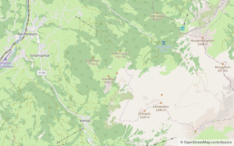
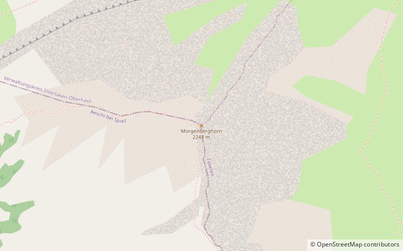
The Morgenberghorn is a mountain of the Bernese Alps, overlooking Lake Thun in the Bernese Oberland. It lies at the northern end of the chain between the valleys of Frutigen and Lauterbrunnen, north of the Schwalmere. ()
BernSwitzerland
Morgenberghorn plan & book
Unleash the traveler in you — discover the cheapest flight deals, find the perfect hotel or hostel nearby, and search for the best car rental prices. Travel at your own pace to discover new places and enjoy your journey.
Morgenberghorn – popular in the area (distance from the attraction)
Nearby attractions include: Schilthorn, Unspunnen Castle, Weissenau Castle, Saxetbach.
4.9 miSENature, Natural attraction, MountainSchilthorn, Mürren
125 min walk • The Schilthorn is a summit in Europe, in the Bernese Alps of Switzerland. It overlooks the valley of Lauterbrunnen in the Bernese Oberland, and is the highest mountain in the range lying north of the Sefinenfurgge Pass.
4.4 miNEHistorical place, Ruins, Historic walking areasUnspunnen Castle, Matten bei Interlaken
113 min walk • Unspunnen Castle is a castle, now in ruins, located in the municipality of Wilderswil in the Bernese Highlands of Switzerland. The castle, likely constructed in the early 12th century, overlooks the city of Interlaken.
3.8 miNEForts and castlesWeissenau Castle, Interlaken
97 min walk • Weissenau Castle is a ruined castle in the municipality of Unterseen of the Canton of Bern in Switzerland. It is a Swiss heritage site of national significance.
4.4 miNENature, Natural attraction, CanyonSaxetbach, Matten bei Interlaken
111 min walk • The Saxetbach is a mountain river south of Interlaken in the Canton of Bern, Switzerland. It is a left tributary of the river Lütschine. It flows through the village Saxeten and joins the Lütschine in Wilderswil. It forms a narrow ravine, the Saxetbach Gorge.
4.7 miNETownUnterseen
120 min walk • One of the main attractions in Unterseen is the beautiful Lake Thun, which offers a variety of water activities such as boating, swimming, and fishing. Visitors can also take leisurely strolls along the lakeshore and enjoy the breathtaking views of the surrounding...
4.6 miSENature, Natural attraction, MountainBietenhorn, Mürren
118 min walk • The Bietenhorn is a mountain of the Bernese Alps, located north of Mürren in the Bernese Oberland. It lies north-east of the Schilthorn, on the range between the Soustal and the main Lauterbrunnen valley.
2.6 miSWNature, Natural attraction, MountainWätterlatte
66 min walk • The Wätterlatte is a mountain of the Bernese Alps, located east of Reichenbach im Kandertal in the Bernese Oberland. It lies on the range west of the Schwalmere, that separates the Suldtal from the Kiental.
5 miNECanalInterlaken ship canal, Interlaken
127 min walk • The Interlaken ship canal is a 2.75-kilometre long canal in the Swiss canton of Bern. It connects Lake Thun with a quay in the town of Interlaken adjacent to Interlaken West railway station, thus allowing shipping services on the lake to serve the town and connect with railway services.
2.3 miSENature, Natural attraction, MountainSchwalmere
59 min walk • The Schwalmere is a mountain of the Bernese Alps, located between Kiental and Lauterbrunnen in the Bernese Oberland. It lies on the range north of the Schilthorn.
4.4 miNEVillage, AreaWilderswil, Matten bei Interlaken
113 min walk • Wilderswil is a village and a municipality in the Interlaken-Oberhasli administrative district in the canton of Bern in Switzerland. Wilderswil belongs to the Small Agglomeration Interlaken with 23,300 inhabitants.
2.6 miSWNature, Natural attraction, MountainDreispitz
67 min walk • The Dreispitz is a mountain of the Bernese Alps, overlooking Kiental in the Bernese Oberland. The summit can be reached by a trail from the Renggpass.