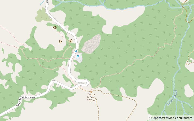
Col de la Croix, Les Diablerets
#12 among attractions in Les Diablerets

Facts and practical information
Col de la Croix is an Alpine pass in the canton of Vaud in Switzerland. ()
Les Diablerets Switzerland
Les Diablerets plan & book
Unleash the traveler in you — discover the cheapest flight deals, find the perfect hotel or hostel nearby, and search for the best car rental prices. Travel at your own pace to discover new places and enjoy your journey.
Col de la Croix – popular in the area (distance from the attraction)
Nearby attractions include: Scex Rouge, Lac Lioson, Pic Chaussy, Diablerets.
 Nature, Natural attraction, Mountain
Scex Rouge, Les Diablerets
93 min walk • The Scex Rouge is a mountain of the Alps, overlooking Les Diablerets in the canton of Vaud.
 Nature, Natural attraction, Lake
Lac Lioson, Les Diablerets
110 min walk • Lac Lioson is a lake in the municipality of Ormont-Dessous, near Les Mosses, in the canton of Vaud, Switzerland. Its surface area is 7 ha. The lake is used for fishing and ice diving.
 Nature, Natural attraction, Mountain
Pic Chaussy, Les Diablerets
96 min walk • Pic Chaussy is a mountain of the Bernese Alps, overlooking Les Diablerets to the south. On its northern side lies the Lac Lioson, whilst the Col des Mosses pass flanks its western side.
 Nature, Natural attraction, Mountain
Diablerets
83 min walk • The Diablerets are a huge ice-covered mountain massif of the Alps, culminating at the Sommet des Diablerets at 3,210 metres above sea level and straddling the border between the Swiss cantons of Vaud and Valais. The northeastern part of the massif stretches also into the canton of Bern.
 View point, Mountain, Bridge
Peak Walk, Les Diablerets
91 min walk • Peak Walk is a pedestrian suspension bridge linking two mountain peaks in the Swiss Alps. It is situated in the Diablerets massif of the Bernese Alps in the canton of Vaud, and connects the peak of Scex Rouge with another peak.
 Nature, Natural attraction, Mountain
Le Chamossaire, Villars-sur-Ollon
75 min walk • Le Chamossaire is a mountain part of the Alpes Vaudoises, overlooking Villars-sur-Ollon on its south face and Les Ormonts valley on its north face. It is located in the canton of Vaud.
 Nature, Natural attraction, Lake
Lac des Chavonnes, Villars-sur-Ollon
55 min walk • Lac des Chavonnes is a lake in the municipality of Ormont-Dessous, above Villars-sur-Ollon, Vaud, Switzerland. Its surface area is 5 ha.
 Nature, Natural attraction, Mountain
L'Argentine
90 min walk • L'Argentine is a mountain of the Vaud Alps, overlooking Solalex above Gryon in the canton of Vaud. The mountain is known by climbers for its Northwest face, the Miroir d'Argentine, which is smooth like a "mirror". The summit is distinguished by the name Haute Pointe and culminates at 2,421 metres above sea level.
 Nature, Natural attraction, Mountain
Le Tarent, Les Diablerets
105 min walk • Le Tarent is a mountain in the western Bernese Alps, overlooking Les Diablerets in the canton of Vaud. At 2,548 metres above sea level, it is the highest mountain of the range lying north of the Col du Pillon.
 Nature, Natural attraction, Mountain
La Para, Les Diablerets
108 min walk • La Para is a mountain of the western Bernese Alps, overlooking Les Diablerets in the canton of Vaud.
 Nature, Natural attraction, Mountain
Tête Ronde
70 min walk • The Tête Ronde is a mountain of the Bernese Alps, located in the canton of Vaud, near the summit of the Diablerets massif of which it is a part. With an elevation of 3,037 metres above sea level, the Tête Ronde is the highest summit entirely within the canton of Vaud.


