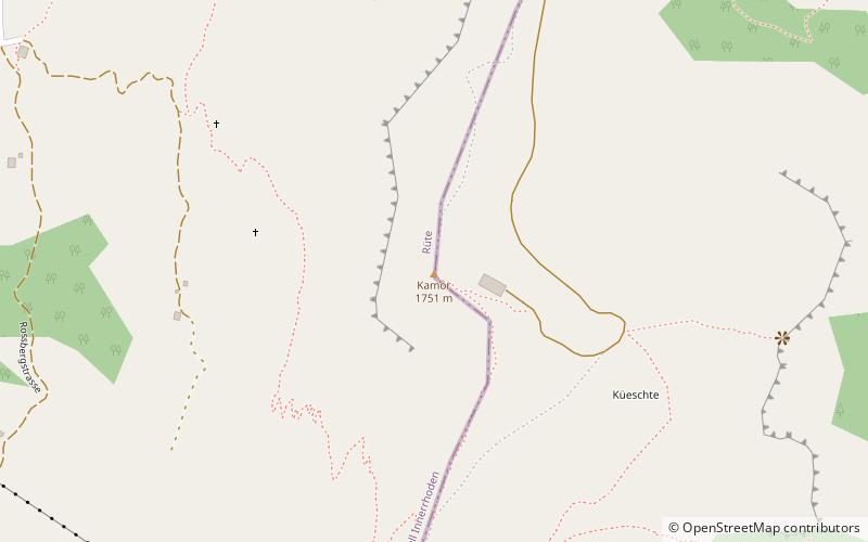
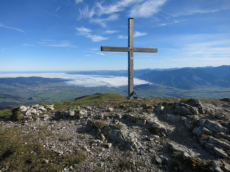
Kamor
#494 among destinations in Switzerland
Facts and practical information
The Kamor is a mountain in the Appenzell Alps and has an elevation of 1,751 m above the sea. It is part of a mountain belt which forms the western boundary of the Rhine Valley and is located on the border of the Swiss cantons Appenzell Innerrhoden and Canton of St. Gallen. ()
Sankt GallenSwitzerland
Kamor plan & book
Unleash the traveler in you — discover the cheapest flight deals, find the perfect hotel or hostel nearby, and search for the best car rental prices. Travel at your own pace to discover new places and enjoy your journey.
Kamor – popular in the area (distance from the attraction)
Nearby attractions include: Seealpsee, Sämtisersee, Wildkirchli, Fälensee.
- 4.3 miWNature, Natural attraction, Lake
Seealpsee
110 min walk • Nestled in the heart of the Swiss Alps, Seealpsee is a serene mountain lake that epitomizes the idyllic beauty of Switzerland's landscape. Located in the canton of Appenzell Innerrhoden, this tranquil body of water sits at an elevation of 1,143 meters, offering...
- 1.9 miSWNature, Natural attraction, Lake
Sämtisersee
48 min walk • Nestled in the picturesque Alpstein massif of northeastern Switzerland, Sämtisersee is a serene mountain lake that offers an idyllic escape into nature. This tranquil body of water is situated at an elevation of approximately 1,205 meters above sea level, making it a...
- 3.7 miWArchaeological site
Wildkirchli
95 min walk • Nestled within the rugged Alpstein massif of Switzerland lies the Wildkirchli, an archaeological site that transports visitors back to the early chapters of human history. This prehistoric site is composed of three caves, which served as a sanctuary for hermits and a...
- 4.2 miSWNature, Natural attraction, Lake
Fälensee
107 min walk • Fälensee is a lake in the Alpstein range of the canton of Appenzell Innerrhoden, Switzerland. At an elevation of 1446 m, the surface area is 0.12 km². It is located in a narrow valley between Hundsteingrat and Roslen-Saxer First.
- 3.1 miWNature, Natural attraction, Mountain
Ebenalp
80 min walk • The Ebenalp is the northernmost summit of the Appenzell Alps. The mountain is a popular hiking destination and has been accessible by cable car from Wasserauen since 1955. Ebenalp attracts up to 200,000 visitors each year.
- 4.1 miNEForts and castles
Wichenstein Castle, Oberriet
104 min walk • Wichenstein Castle is a castle in the municipality of Oberriet of the Canton of St. Gallen in Switzerland. It is a Swiss heritage site of national significance.
- 2.9 miSWNature, Natural attraction, Mountain
Hüser
75 min walk • The Furgglenfirst is a multi-summited mountain of the Appenzell Alps located on the border between the Swiss cantons of Appenzell Innerrhoden and St. Gallen. The main summit, named Hintere Hüser, has a height of 1,951 metres above sea level.
- 4.5 miNWForts and castles
Appenzell Castle, Appenzell
116 min walk • Appenzell Castle is a castle in the Appenzell District of the canton of Appenzell Innerrhoden in Switzerland. It is one of a few 16th century stone buildings in Appenzell. It is part of the Swiss heritage site of national significance.
- 4.7 miSWNature, Natural attraction, Mountain
Hundstein
121 min walk • The Hundstein is a mountain in the Alpstein massif of the Appenzell Alps, located south of Schwende in the canton of Appenzell Innerrhoden. It lies on the range east of the Altmann, between the valleys of the Seealpsee and the Fälensee.
- 4.3 miSWNature, Natural attraction, Mountain
Marwees
111 min walk • The Marwees is a mountain in the Alpstein massif of the Appenzell Alps, located south of Schwende in the canton of Appenzell Innerrhoden. It lies on the range east of the Altmann, between the valleys of the Seealpsee and the Sämtisersee.
- 0.7 miWNature, Natural attraction, Mountain
Hoher Kasten
19 min walk • The Hoher Kasten is a mountain in the Appenzell Alps, overlooking the Rhine in Eastern Switzerland. It is located on the border between the cantons of Appenzell Innerrhoden and St. Gallen.