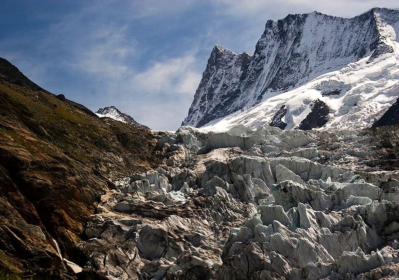
Lower Grindelwald Glacier

Gallery (2)
Map
Map
Gallery
Facts and practical information
The Lower Grindelwald Glacier is a Glacier in the Swiss Bernese Alps, situated to the south-east of Grindelwald. It starts below the Agassizhorn and the Strahlegghörner and is connected with the Finsteraar Glacier via the Finsteraarjoch. ()
Local name: Unterer Grindelwaldgletscher Length: 3.85 miMaximum elevation: 12779 ftMinimal elevation: 4426 ftCoordinates: 46°35'26"N, 8°3'38"E
Location
Bern
ContactAdd
Social media
Add
Day trips


