Stein Glacier
#1385 among destinations in Switzerland

Facts and practical information
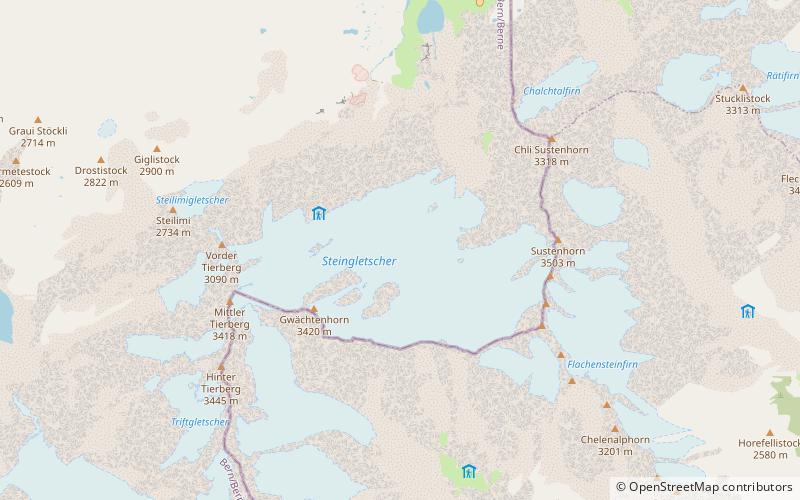
The Stein Glacier is a 4 km long glacier situated in the Urner Alps in the canton of Berne in Switzerland. In 1973 it had an area of 6.06 km2. ()
BernSwitzerland
Stein Glacier plan & book
Unleash the traveler in you — discover the cheapest flight deals, find the perfect hotel or hostel nearby, and search for the best car rental prices. Travel at your own pace to discover new places and enjoy your journey.
Stein Glacier – popular in the area (distance from the attraction)
Nearby attractions include: Trift Bridge, Steinsee, Triftsee, Sustenhorn.
 Bridge
Trift Bridge
86 min walk • Suspended amidst the Swiss Alps, the Trift Bridge holds the title of one of the most spectacular pedestrian suspension bridges within the heart of Switzerland. Towering at an impressive height of 100 meters and extending 170 meters across the Triftsee Lake, the bridge...
 Nature, Natural attraction, Lake
Steinsee
49 min walk • Nestled in the serene landscapes of Switzerland, Steinsee is a picturesque lake that offers a tranquil retreat from the hustle and bustle of urban life. Known for its crystal-clear waters and the stunning mountainous backdrop, Steinsee is a hidden gem for nature...
 Nature, Natural attraction, Lake
Triftsee
85 min walk • The Triftsee is a lake in the Urner Alps near Gadmen in the canton of Berne, Switzerland. It was formed recently by the melting of the lower part of Trift Glacier.
 Scenic peak for camping, hiking and skiing
Sustenhorn
33 min walk • The Sustenhorn is a 3,502-metre-high mountain in the Uri Alps, located on the border between the cantons of Bern and Uri. It overlook Susten Pass from the south. Both sides of the massif are glaciated.
 Nature, Natural attraction, Mountain
Gwächtenhorn
22 min walk • The Gwächtenhorn is a 3,420 metres high mountain in the Urner Alps, located on the border between the cantons of Bern and Uri. It overlooks the Stein Glacier and the Susten Pass on its north side and the Chelen Glacier on its south side.
 High Alpine pass with famed driving route
Susten Pass
63 min walk • Susten Pass is a mountain pass in the Swiss Alps. The pass road, built from 1938–1945, connects Innertkirchen in the canton of Bern with Wassen in the canton of Uri. A 300-metre long tunnel crosses the pass at 2,224 metres.
 Nature, Natural attraction, Mountain
Fleckistock
86 min walk • The Fleckistock is a 3,417 metres high mountain in the Urner Alps, overlooking Wassen in the canton of Uri. It is the highest summit of the group lying east of the pass of Sustenjoch.
 Nature, Natural attraction, Mountain
Dammastock
96 min walk • The Dammastock is the highest mountain in the Urner Alps in Switzerland and is part of the Winterberg massif. Its summit ridge forms the border between the cantons of Uri and the Valais. It is the highest summit in the canton of Uri.
 Nature, Natural attraction, Mountain
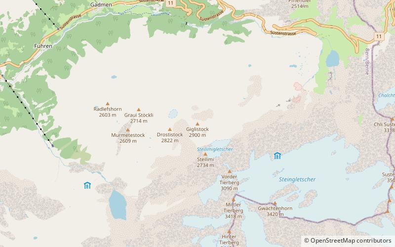
Giglistock
55 min walk • The Giglistock is a mountain of the Urner Alps, located south of Gadmen in the Bernese Oberland.
 Nature, Natural attraction, Mountain
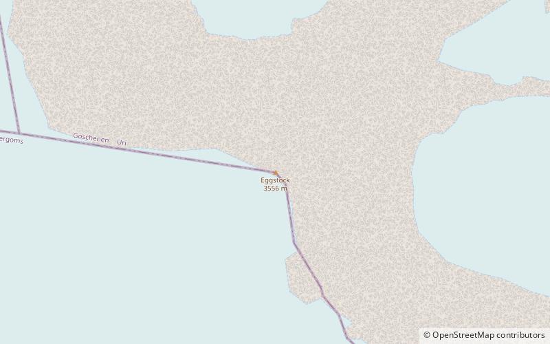
Eggstock
81 min walk • The Eggstock, is a minor prominence of the Uri Alps, forming the northern pillar of the Dammastock on the border between the cantons of Valais and Uri. The tripoint between the cantons of Bern, Valais and Uri is located 600 m west of the summit.
 Nature, Natural attraction, Mountain
Hinter Tierberg
45 min walk • The Hinter Tierberg is a 3,445 metres high mountain in the Uri Alps, located on the border between the cantons of Bern and Uri. It overlooks the Trift Glacier on its west side and the Chelen Glacier on its east side. The massif of the Tierberg consists of several mountains, they are: Vorder Tierberg, Mittler Tierberg and Hinter Tierberg.


