Banthat Thong Road, Bangkok
Map
Facts and practical information
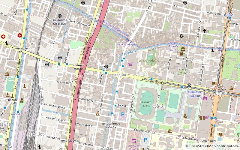
Banthat Thong Road is a street in Bangkok. It runs 2.2 kilometres from its junction with Rama IV Road at Saphan Lueang Intersection, through Pathum Wan and Ratchathewi districts, north to Phet Phra Ram Intersection, where it meets Phetchaburi Road. It crosses Rama I Road at Charoen Phon Intersection, near the National Stadium, and the area is home to a large number of sporting goods shops. The southern section of the road runs parallel to the canal Khlong Suan Luang, which also gives its name to the neighbourhood. The area's land is owned by Chulalongkorn University, whose Office of Property Management redeveloped most of the neighbourhood in the 2010s. ()
Coordinates: 13°44'51"N, 100°31'26"E
Address
ลุมพินี (ปทุมวัน)Bangkok
ContactAdd
Social media
Add
Getting there by public transportation
Public transportation stops near this location
- Metro
- Bus
- Train
- Ferry
 Metro
Metro
- Calculate routeSapan Charoenpol 5 min walk
- Calculate routeBaan Krua Nua 8 min walk
- Calculate routeกระทรวงพลังงาน 13 min walk
- Calculate routeยศเส 13 min walk
- Calculate routeNational Stadium 8 min walk
- Calculate routeหอศิลป์กรุงเทพฯ 10 min walk
- Calculate routeมังกร2. จิระโรยขนส่ง 17 min walk
- Calculate routeHualamphong 19 min walk
- Calculate routeNational Stadium 10 min walk
- Calculate routeRatchathewi 16 min walk
- Calculate routeSiam 19 min walk
- Calculate routeHua Lamphong 21 min walk
- Calculate routeBangkok 20 min walk
- Calculate routeUruphong 21 min walk
- Calculate routeYommarat 21 min walk
- Calculate routePhaya Thai 25 min walk
Day trips


Frequently Asked Questions (FAQ)
Which popular attractions are close to Banthat Thong Road?
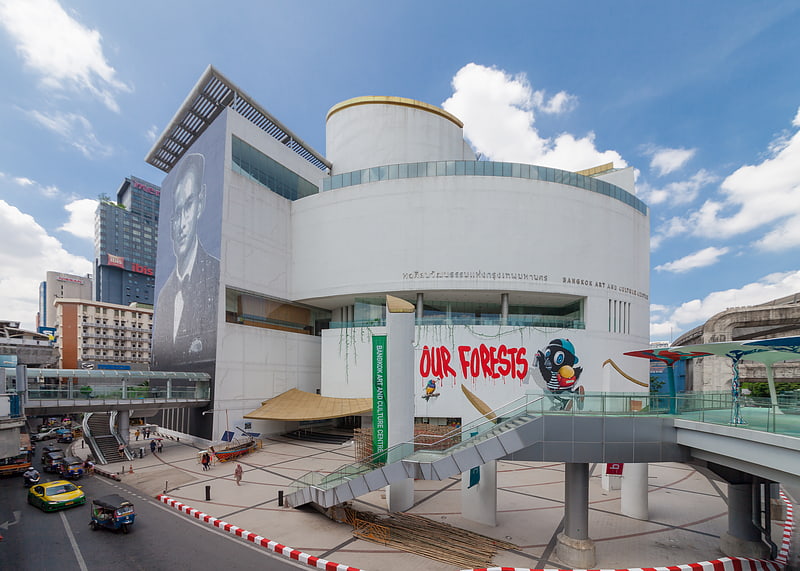
Nearby attractions include Ban Khrua, Bangkok (8 min walk), Jim Thompson House, Bangkok (8 min walk), Wat Borom Niwat, Bangkok (11 min walk), Bangkok Art and Culture Centre, Bangkok (11 min walk).
How to get to Banthat Thong Road by public transport?
The nearest stations to Banthat Thong Road:
Ferry
Bus
Metro
Train
Ferry
- Sapan Charoenpol • Lines: Golden Mount (5 min walk)
- Baan Krua Nua (8 min walk)
Bus
- National Stadium • Lines: 11, 11 ปอ. เมกาบางนา - เอ็ม บี เค เซ, 508 (8 min walk)
- หอศิลป์กรุงเทพฯ • Lines: 508 (10 min walk)
Metro
- National Stadium • Lines: BTS Silom (10 min walk)
- Ratchathewi • Lines: BTS Sukhumvit (16 min walk)
Train
- Bangkok (20 min walk)
- Uruphong (21 min walk)