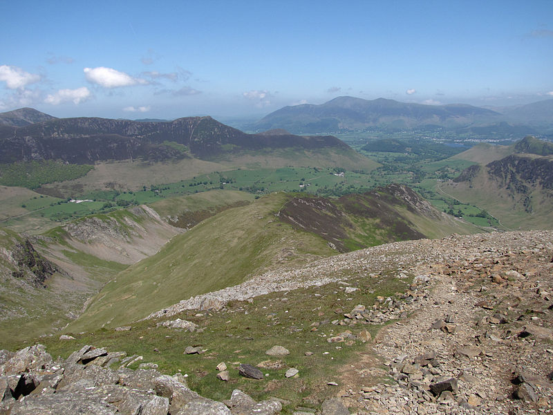
Hindscarth
#1223 among destinations in the United Kingdom


Facts and practical information
Hindscarth is a mountain between the valleys of Buttermere and Newlands, in the north-western part of the English Lake District. The fell's name is derived from two words from the Old Norse language, Hind and Skarth, and means the pass used by the red deer. ()
EnglandUnited Kingdom
Hindscarth – popular in the area (distance from the attraction)
Nearby attractions include: Buttermere, Innominate Tarn, Moss Force, Fleetwith Pike.
 Nature, Natural attraction, Lake
Buttermere
54 min walk • Nestled in the serene landscape of the Lake District National Park, Buttermere stands as a picturesque emblem of natural beauty in the United Kingdom. This tranquil lake, flanked by the dramatic crests of the surrounding fells, presents an idyllic setting that has...
 Nature, Natural attraction, Lake
Innominate Tarn, Lake District National Park
64 min walk • Innominate Tarn is a small tarn in the north of the Lake District National Park in England. It is situated at 520 metres above sea level, near the summit of Haystacks. The name Innominate means "without a name". It was formerly known as Loaf Tarn. The tarn is the location where Alfred Wainwright's ashes were scattered.
 Nature, Natural attraction, Waterfall
Moss Force, Borrowdale
39 min walk • Moss Force is a waterfall situated within the Lake District National Park in the English county of Cumbria. It is located 10 km SW of the town of Keswick at Newlands Hause, the pass between the Newlands Valley and the Buttermere Valley.
 Nature, Natural attraction, Cliff
Fleetwith Pike, Lake District National Park
39 min walk • Fleetwith Pike is a fell in the English Lake District in the county of Cumbria which reaches a height of 648 metres. The fell is a well-known feature of the area as it casts an imposing presence over Buttermere and the Honister Pass on the B5289 motor road between Borrowdale and Buttermere.
 Nature, Natural attraction, Rock
Bowder Stone, Borrowdale
61 min walk • The Bowder Stone is a large andesite lava boulder, that fell 200 metres from the Bowder Crag on Kings How between 13,500 and 10,000 years ago. The stone is situated in Borrowdale, Cumbria, England, at grid reference NY25401639.
 Nature, Natural attraction, Lake
Blackbeck Tarn, Lake District National Park
63 min walk • Blackbeck Tarn is a small tarn in Cumbria, England, situated near the summit of Haystacks in the Buttermere Valley. At an elevation of 486 m, the lake has an area of 0.95 hectares and measures 183 m × 80 m, with a maximum depth of 2.5 m.
 Mine
MineHonister Slate Mine, Keswick
50 min walk • The Honister Slate Mine in Cumbria is the last working slate mine in England. Quarrying for Westmorland green slate has been taking place in the area since 1728.
 Hill
HillHaystacks, Lake District National Park
63 min walk • Haystacks, or Hay Stacks, is a hill in England's Lake District, situated at the south-eastern end of the Buttermere Valley. Although not of any great elevation, Haystacks has become one of the most popular fells in the area.
 Nature, Natural attraction, Cliff
Castle Crag
46 min walk • Castle Crag is a hill in the North Western Fells of the English Lake District. It is the smallest hill included in Alfred Wainwright's influential Pictorial Guide to the Lakeland Fells, the only Wainwright below 1,000 feet.
 Church
Newlands Church
51 min walk • Newlands Church is a 16th-century church situated less than 500 metres west of the hamlet of Little Town, Cumbria, England in the Newlands Valley of the Lake District.
 Nature, Natural attraction, Hill
Dale Head
23 min walk • Dale Head is a fell in the north-western sector of the Lake District, in northern England. It is 753 metres or 2,470 feet above sea level and stands immediately north of Honister Pass, the road between Borrowdale and Buttermere.
