Hulme Locks Branch Canal, Manchester

Gallery (3)
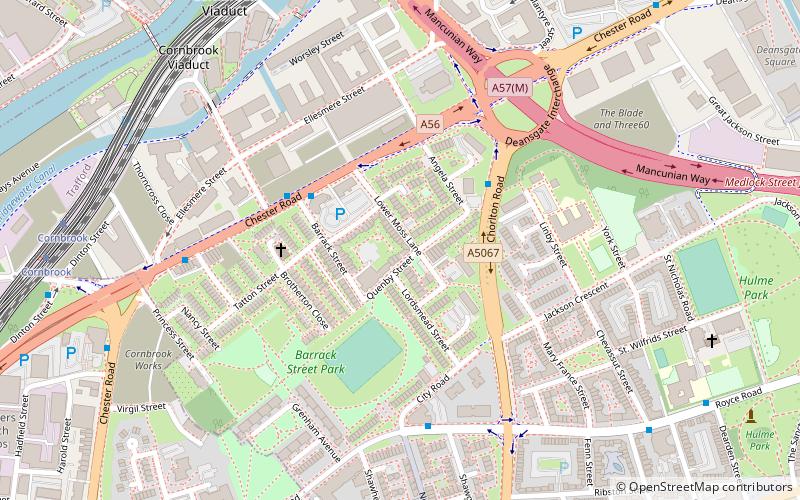
Map
Map
Gallery
Facts and practical information
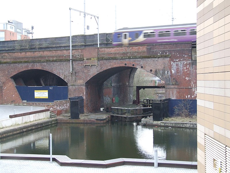
The Hulme Locks Branch Canal is a canal in the city of Manchester. It is 200m in length and was built to provide a direct waterway between the Mersey and Irwell Navigation and the Bridgewater Canal. The canal opened in 1838 and was superseded in 1995 by a new lock at Pomona Dock 3. As both of its locks remain closed, the canal is now overgrown. ()
Coordinates: 53°28'12"N, 2°15'36"W
Address
HulmeManchester
ContactAdd
Social media
Add
Getting there by public transportation
Public transportation stops near this location
- Bus
- Tram
- Train
 Bus
Bus
- Calculate routeCornbrook 8 min walk
- Calculate routeDeansgate-Castlefield 14 min walk
- Calculate routePomona 21 min walk
- Calculate routeSt. Peter's Square 23 min walk
- Calculate routeStretford Road/Chorlton Road 8 min walk
- Calculate routeDeansgate 12 min walk
- Calculate routeManchester Oxford Road 20 min walk
- Calculate routeSalford Central 24 min walk
- Calculate routeSalford Crescent 33 min walk
Maps MetrolinkMaps
 Metrolink / Rail
MetrolinkMapsMetrolink / RailDay trips


Frequently Asked Questions (FAQ)
Which popular attractions are close to Hulme Locks Branch Canal?
Nearby attractions include Church of St George, Manchester (4 min walk), North Pennine Ring, Manchester (9 min walk), Owen Street, Manchester (10 min walk), Hulme Park, Manchester (10 min walk).
How to get to Hulme Locks Branch Canal by public transport?
The nearest stations to Hulme Locks Branch Canal:
Tram
Bus
Train
Tram
- Cornbrook • Lines: Airp, Altr, Asht, Bury, Corn, Dean, Eccl, EDid, Mcuk, Picc, Roch, Shaw, TrfC, Vict (8 min walk)
- Deansgate-Castlefield • Lines: Airp, Altr, Asht, Bury, Dean, Eccl, EDid, Mcuk, Picc, Roch, Shaw, Vict (14 min walk)
Bus
- Stretford Road/Chorlton Road • Lines: 53 (8 min walk)
Train
- Deansgate (12 min walk)
- Manchester Oxford Road (20 min walk)