Beinn Bheula, Loch Lomond and The Trossachs National Park
#54 among attractions in Loch Lomond and The Trossachs National Park
![Beinn Bheula location map](https://tzmedia.b-cdn.net/media/images/static-maps/gb/56_1418_-4_97207.jpg)
Facts and practical information
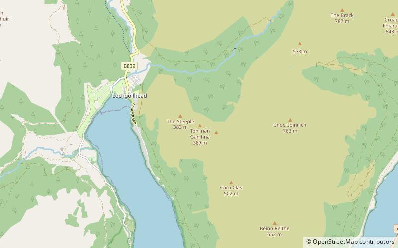
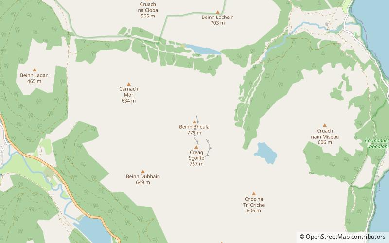
Beinn Bheula is a mountain located between Loch Goil and Loch Eck. It is part of the Arrochar Alps range. Beinn Bheula appears rugged from Lochgoilhead, with several summits, the highest of which is Caisteal Dubh. It is commonly climbed from Loch Goil ()
Loch Lomond and The Trossachs National Park United Kingdom
Loch Lomond and The Trossachs National Park plan & book
Unleash the traveler in you — discover the cheapest flight deals, find the perfect hotel or hostel nearby, and search for the best car rental prices. Travel at your own pace to discover new places and enjoy your journey.
Beinn Bheula – popular in the area (distance from the attraction)
Nearby attractions include: Carrick Castle, Ben Donich, Stob na Boine Druim-fhinn, Cnoc Coinnich.
3.4 miSEForts and castles, Vernacular architectureCarrick Castle, Loch Lomond and The Trossachs National Park
88 min walk • Carrick Castle is a 14th-century tower house on the west shore of Loch Goil on the Cowal peninsula in Argyll and Bute, Scotland. It is located between Cuilmuich and Carrick, 4 miles south of Lochgoilhead. The castle stands on a rocky peninsula, and was formerly defended to landward by a ditch and drawbridge.
5.4 miNENature, Natural attraction, MountainBen Donich, Loch Lomond and The Trossachs National Park
139 min walk • Ben Donich or Beinn Dòmhnaich is a mountain located in the Arrochar Alps, near Loch Goil in Argyll and Bute. It is a Corbett and part of the Ardgoil range with its sister The Brack. The closest settlement to Ben Donich is the village of Lochgoilhead.
2.8 miNNature, Natural attraction, MountainStob na Boine Druim-fhinn
71 min walk • Stob na Boine Druim-fhinn is a mountain in the Arrochar Alps in the Argyll Highlands. The mountain itself is part of the group of mountains within the Arrochar Alps to the west of Loch Goil. The mountain can be seen from Lochgoilhead.
5.1 miENature, Natural attraction, MountainCnoc Coinnich, Loch Lomond and The Trossachs National Park
130 min walk • Cnoc Coinnich is a Corbett situated in Ardgoil in the Argyll & Bute council region and forms part of the Arrochar Alps. Cnoc Coinnich missed out on Corbett status by one metre until July 2016 when it was resurveyed at the instigation of the Scottish Mountaineering Club.
5.5 miSWNature, Natural attraction, MountainBeinn Mhòr, Loch Lomond and The Trossachs National Park
140 min walk • Beinn Mhòr is the highest mountain on the Cowal Peninsula west of Loch Eck in Argyll and Bute, Scotland. It has a high topographic prominence to height ratio and consequently commands a good all round view.
6 miSWMountainCreag Tharsuinn
153 min walk • Creag Tharsuinn is a mountain in the Arrochar Alps of Scotland. It lies in the Cowal peninsula, Argyll and Bute. Taking the form of a long ridge, the peak rises steeply above the surrounding glens. It is usually climbed from Garvie in Glendaruel. The nearest village is Kilmodan.
1.5 miNNature, Natural attraction, MountainBeinn Lochain
39 min walk • Beinn Lochain is one of the Arrochar Alps at 703 metres, in the Argyll Highlands. The mountain is situated to the west of Lochgoilhead.
5.7 miEHarborFinnart Oil Terminal
146 min walk • Finnart Oil Terminal, also known as Finnart Ocean Terminal or Chap Point, is an oil depot on the eastern shore of Loch Long, Firth of Clyde on the west coast of Scotland, about 2 miles to the north of Garelochhead on the A814 road to Arrochar.
3.1 miEParkLoch Goil
80 min walk • Loch Goil; is a small sea loch forming part of the coast of the Cowal peninsula in Argyll and Bute, Scotland. The sea loch is entirely within the Loch Lomond and The Trossachs National Park. It is an arm of Loch Long. The village of Lochgoilhead stands at its head.
2.7 miWParkArgyll Forest Park, Loch Lomond and The Trossachs National Park
69 min walk • Argyll Forest Park is a forest park located on the Cowal peninsula in Argyll and Bute, Scottish Highlands. Established in 1935, it was the first forest park to be created in the United Kingdom. The park is managed by Forestry and Land Scotland, and covers 211 km2 in total.
4 miNENature, Natural attraction, MountainTom nan Gamhna, Loch Lomond and The Trossachs National Park
102 min walk • Tom nan Gamhna is a mountain within the Ardgoil Peninsula and Arrochar Alps near Lochgoilhead in Argyll, Scottish Highlands. The mountain reaches a height of 389 m.