The More, Watford
Map
Facts and practical information
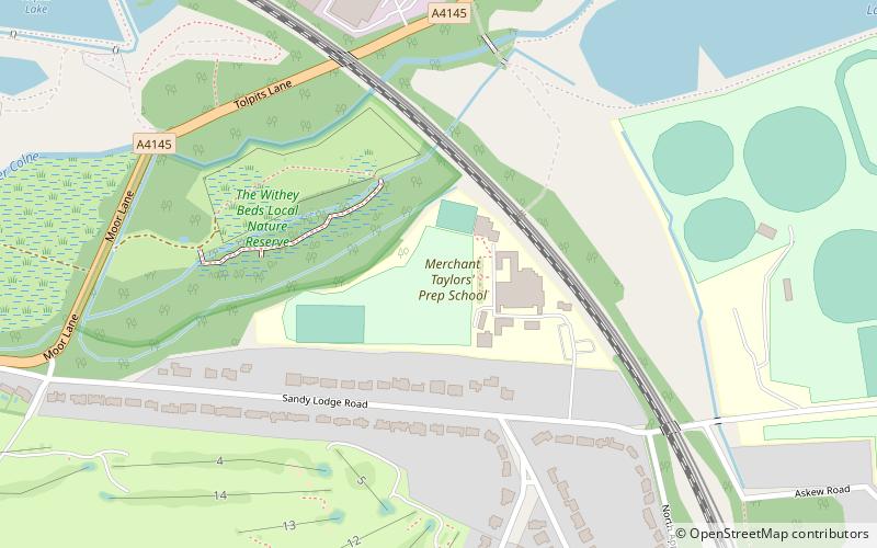
The More was a 16th-century palace in the parish of Rickmansworth, Hertfordshire, England, where Catherine of Aragon lived after the annulment of her marriage to Henry VIII. It had been owned by Cardinal Wolsey. It lay at the northeast corner of the later More Park estate on the edge of the Colne flood plain. The Treaty of the More was celebrated here by Henry VIII and the French ambassadors. In 1527, the French ambassador, Jean du Bellay, thought the house more splendid than Hampton Court. Nothing now remains above ground. The site is a scheduled ancient monument. In the grounds of the school exist parts of at least two large stone pillars approximately one metre in length which are said to be part of the original manor. ()
Coordinates: 51°38'3"N, 0°26'19"W
Address
Watford
ContactAdd
Social media
Add
Getting there by public transportation
Public transportation stops near this location
- Metro
- Bus
 Metro
Metro
- Calculate routeMoor Park 11 min walk
- Calculate routeCroxley 24 min walk
- Calculate routeCroxley Metropolitan Station 24 min walk
- Calculate routeHazelwood Road 24 min walk
- Calculate routeHarvey Road 25 min walk
Day trips


Frequently Asked Questions (FAQ)
Which popular attractions are close to The More?
Nearby attractions include The Withey Beds, Watford (6 min walk), Croxley Common Moor, Watford (15 min walk).
How to get to The More by public transport?
The nearest stations to The More:
Metro
Bus
Metro
- Moor Park • Lines: Metropolitan (11 min walk)
- Croxley • Lines: Metropolitan (24 min walk)
Bus
- Croxley Metropolitan Station • Lines: 724, R2 (24 min walk)
- Hazelwood Road • Lines: R2 (24 min walk)