Chapel Carn Brea
Map

Gallery

Facts and practical information
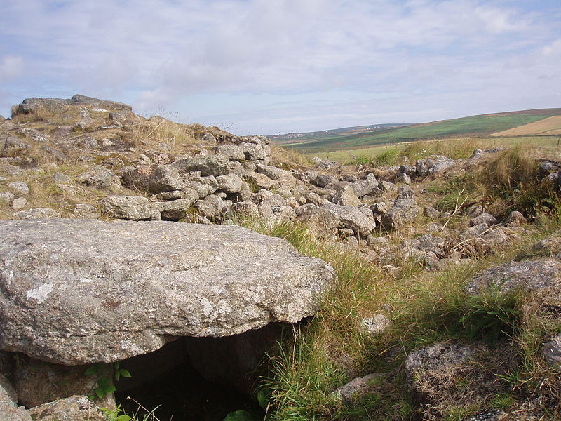
Chapel Carn Brea is an elevated Hercynian granite outcrop, owned by the National Trust at the southern edge of the civil parish of St Just, Cornwall, England, United Kingdom. The hill is 5 kilometres south of St Just and 3.5 kilometres east of Sennen Cove, and just to the north of the A30 London to Land's End road, which runs through the village of Crows-an-Wra. It should not be confused with another Carn Brea, the hill overlooking the Camborne–Redruth area. ()
Elevation: 650 ftProminence: 98 ftCoordinates: 50°5'42"N, 5°39'23"W
Location
England
ContactAdd
Social media
Add
Day trips
Chapel Carn Brea – popular in the area (distance from the attraction)
Nearby attractions include: Minack Theatre, Cot Valley, Maen Castle, Ballowall Barrow.


