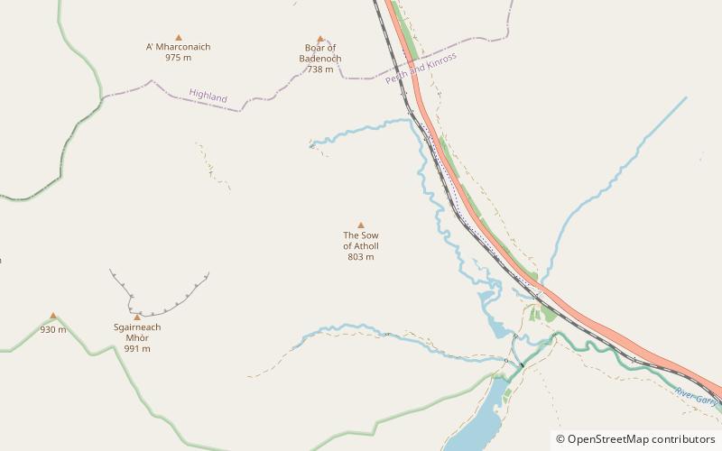
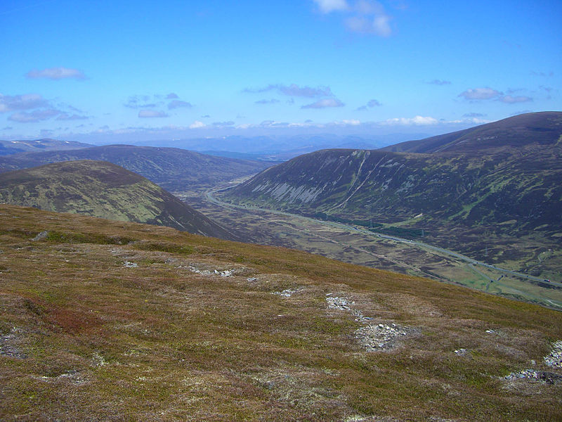
The Sow of Atholl, Cairngorms National Park

Gallery (3)
Map
Map
Gallery
Facts and practical information
The Sow of Atholl is a Scottish hill which is situated 27 kilometres west-northwest of the town of Blair Atholl in Perth and Kinross council area. It stands on the western side of the Pass of Drumochter in a group of hills which lie around Coire Dhomhain. ()
Elevation: 2635 ftProminence: 545 ftCoordinates: 56°50'17"N, 4°15'19"W
Address
Cairngorms National Park
ContactAdd
Social media
Add
Day trips


