Chartist Cave, Brecon Beacons
#73 among attractions in Brecon Beacons

Facts and practical information
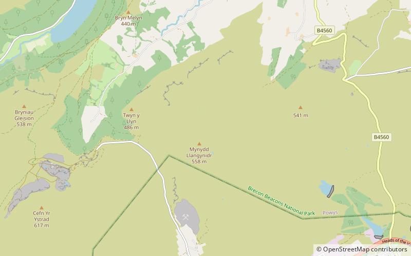
Chartist Cave is a culturally significant cave on Mynydd Llangynidr in southern Powys, Wales. The entrance is a broad arch formed of Twrch Sandstone which overlies the Carboniferous Limestone immediately beneath. ()
Brecon Beacons United Kingdom
Chartist Cave – popular in the area (distance from the attraction)
Nearby attractions include: Bedwellty House and Park, Llangynidr Bridge, Tor y Foel, Conway Road Methodist Church.
 Park, History museum, Museum
Bedwellty House and Park, Tredegar
114 min walk • Bedwellty House is a Grade II-listed house and gardens in Tredegar, in the Sirhowy Valley in south-east Wales. It was built in the early 19th century on the site of an earlier building and subsequently enlarged into its present form by mid-century.
 Bridge
Llangynidr Bridge, Brecon Beacons
87 min walk • Llangynidr Bridge, also known as "Coed-yr-Ynys Bridge", is an early 18th-century bridge that crosses the River Usk to the north of Llangynidr, Powys, Wales. It carries the B4560 road towards Bwlch.
 Nature, Natural attraction, Mountain
Tor y Foel, Brecon Beacons
66 min walk • Tor y Foel is a hill in the Brecon Beacons National Park in the county of Powys in Wales. It is located on the eastern flank of Talybont Reservoir, and the summit at 551m is marked by a small cairn.
 Church
Conway Road Methodist Church, Brecon Beacons
79 min walk • Conway Road Methodist Church is a Nonconformist chapel in Canton, Cardiff. It stands at the junction of Conway Road and Romilly Crescent and has been a Grade II Listed Building since 1975. It is the largest Methodist chapel still in use in Cardiff.
 Nature, Natural attraction, Mountain
Cefn yr Ystrad, Brecon Beacons
68 min walk • Cefn yr Ystrad is a mountain in the Brecon Beacons National Park in Wales. It is an outlier of the Central Beacons group. The broad northeast - southwest aligned ridge reaches an elevation of 619 metres.
 Nature, Natural attraction, Mountain
Mynydd Llangynidr, Brecon Beacons
56 min walk • Mynydd Llangynidr is a mountain in the Brecon Beacons National Park largely in the county of Powys, south Wales. Its southern slopes extend into the northernmost parts of the county borough of Blaenau Gwent.
 Dam
DamPontsticill Reservoir, Brecon Beacons
113 min walk • Pontsticill Reservoir or Taf Fechan Reservoir is a large reservoir on the Taf Fechan lying partly in the county of Powys and partly within the county borough of Merthyr Tydfil in south Wales. It lies within the Brecon Beacons National Park and Fforest Fawr Geopark.
 Nature, Natural attraction, Mountain
Mynydd Llangatwg, Brecon Beacons
115 min walk • Mynydd Llangatwg or Llangattock Mountain is a hill in the Brecon Beacons National Park in the county of Powys, south Wales. It is named from the village of Llangatwg which sits in the valley of the River Usk to the north of it.
 Nature, Natural attraction, Mountain
Allt Lwyd, Brecon Beacons
91 min walk • Allt Lwyd is a top of Waun Rydd in the Brecon Beacons National Park, in southern Powys, Wales. The summit is heathery and marked by a small pile of stones. It is found at the end of Waun Rydd's south-east ridge. It overlooks Talybont Reservoir, and has the Talybont Forest on its steep flanks.
 Nature, Natural attraction, Mountain
Craig y Cilau, Brecon Beacons
99 min walk • Craig y Cilau is a limestone escarpment in the Brecon Beacons National Park in Powys, Wales. It was declared a national nature reserve in 1959 because of its importance for wildlife, particularly plants.
 Nature, Natural attraction, Mountain
Myarth, Brecon Beacons
112 min walk • Myarth is a hill in the Usk Valley in the county of Powys in South Wales, about 2 miles west of Crickhowell. Its summit at 292 metres is covered by trees, whilst the larger part of its slopes are also wooded. It is listed as a Marilyn.